De Buc à la pâtisserie Durand - maison historique du Paris-Brest à Maisons-Lafitte
- 52.2 km
- 365 m
- 365 m
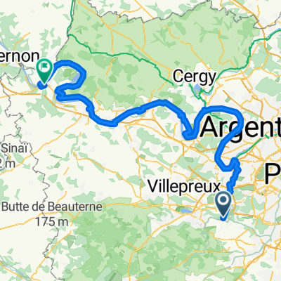
- Buc, Île-de-France Region, France
A cycling route starting in Buc, Île-de-France Region, France.
Overview
Loop passing through Gif-sur-Yvette on the way out, St Remy on the way back. Two very difficult climbs on the return, between Saint-Remy and Magny and at Chateaufort, each with a flight of stairs at the top of the climb.
created this 5 years ago
Continue with Bikemap
You would like to ride de Buc à la Voie Verte de l'aérotrain or customize it for your own trip? Here is what you can do with this Bikemap route:
Free trial for 3 days, or one-time payment. More about Bikemap Premium.
Discover more Premium features.
Get Bikemap PremiumFrom our community
Open it in the app