

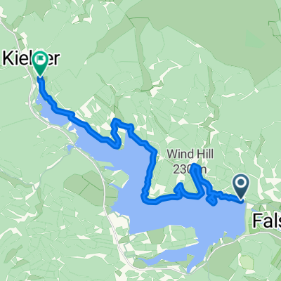
Kielder Water
A cycling route starting in Rochester, England, United Kingdom.
Overview
About this route
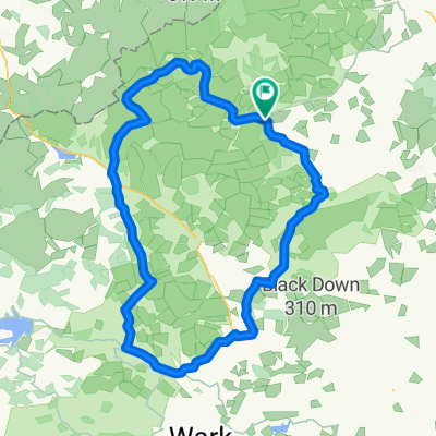
Park in small layby/grass verge just off Shilling Pot road near driveway to Hawkhope car park (see Google Maps)
- -:--
- Duration
- 48.4 km
- Distance
- 444 m
- Ascent
- 444 m
- Descent
- ---
- Avg. speed
- ---
- Max. altitude
Route quality
Waytypes & surfaces along the route
Waytypes
Cycleway
27.1 km
(56 %)
Track
17.4 km
(36 %)
Surfaces
Paved
3.4 km
(7 %)
Unpaved
29.1 km
(60 %)
Gravel
29.1 km
(60 %)
Asphalt
3.4 km
(7 %)
Undefined
16 km
(33 %)
Continue with Bikemap
Use, edit, or download this cycling route
You would like to ride Kielder Water or customize it for your own trip? Here is what you can do with this Bikemap route:
Free features
- Save this route as favorite or in collections
- Copy & plan your own version of this route
- Sync your route with Garmin or Wahoo
Premium features
Free trial for 3 days, or one-time payment. More about Bikemap Premium.
- Navigate this route on iOS & Android
- Export a GPX / KML file of this route
- Create your custom printout (try it for free)
- Download this route for offline navigation
Discover more Premium features.
Get Bikemap PremiumFrom our community
Other popular routes starting in Rochester
 Periple 11 / 28
- Distance
- 167.7 km
- Ascent
- 1,250 m
- Descent
- 1,182 m
- Location
- Rochester, England, United Kingdom
 BfCiC recce
- Distance
- 214.8 km
- Ascent
- 940 m
- Descent
- 1,119 m
- Location
- Rochester, England, United Kingdom
 Kielder észak
- Distance
- 17.1 km
- Ascent
- 178 m
- Descent
- 185 m
- Location
- Rochester, England, United Kingdom
 Kielder Water
- Distance
- 48.4 km
- Ascent
- 444 m
- Descent
- 444 m
- Location
- Rochester, England, United Kingdom
 Lew and Cal round Kielder
- Distance
- 41.6 km
- Ascent
- 253 m
- Descent
- 253 m
- Location
- Rochester, England, United Kingdom

Edge810®
Rochester Cycling- Distance
- 40.1 km
- Ascent
- 519 m
- Descent
- 522 m
- Location
- Rochester, England, United Kingdom
 Pt9 THE FINAL DAY
- Distance
- 93.5 km
- Ascent
- 509 m
- Descent
- 675 m
- Location
- Rochester, England, United Kingdom
 wild camping weekend
- Distance
- 89.9 km
- Ascent
- 872 m
- Descent
- 872 m
- Location
- Rochester, England, United Kingdom
Open it in the app