
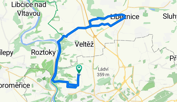
Čimice - podél Vltavy - Klecánky - Klecany - Líbeznice - a zpět
A cycling route starting in Roztoky, Central Bohemia, Czechia.
Overview
About this route
Designed for mountain biking. From Klecánky to Klecany an elevation gain of 120 m, from the Vltava to Bohnice an elevation gain of 100 m (on average about 6% incline). Be careful, on the descent into Líbeznice between the fields just before the village, you cross a bypass under construction (open Street Map and you'll see where it is - around kilometer 16).
- -:--
- Duration
- 32.5 km
- Distance
- 378 m
- Ascent
- 378 m
- Descent
- ---
- Avg. speed
- ---
- Max. altitude

Route quality
Waytypes & surfaces along the route
Waytypes
Road
10.1 km
(31 %)
Quiet road
9.4 km
(29 %)
Surfaces
Paved
25 km
(77 %)
Unpaved
2.6 km
(8 %)
Asphalt
25 km
(77 %)
Ground
2.3 km
(7 %)
Route highlights
Points of interest along the route
Point of interest after 16 km
Průjezd staveništěm (výstavba nové silnice).
Continue with Bikemap
Use, edit, or download this cycling route
You would like to ride Čimice - podél Vltavy - Klecánky - Klecany - Líbeznice - a zpět or customize it for your own trip? Here is what you can do with this Bikemap route:
Free features
- Save this route as favorite or in collections
- Copy & plan your own version of this route
- Sync your route with Garmin or Wahoo
Premium features
Free trial for 3 days, or one-time payment. More about Bikemap Premium.
- Navigate this route on iOS & Android
- Export a GPX / KML file of this route
- Create your custom printout (try it for free)
- Download this route for offline navigation
Discover more Premium features.
Get Bikemap PremiumFrom our community
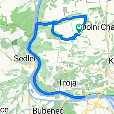
Other popular routes starting in Roztoky
 Na sever od Čimic z Prahy po silnici
- Distance
- 53.3 km
- Ascent
- 305 m
- Descent
- 305 m
- Location
- Roztoky, Central Bohemia, Czechia
 velké lávkové kolečko Troja Veltrusy
- Distance
- 56.7 km
- Ascent
- 218 m
- Descent
- 218 m
- Location
- Roztoky, Central Bohemia, Czechia
 Okoř - Nelahozeves - Veltrusy
- Distance
- 69 km
- Ascent
- 330 m
- Descent
- 329 m
- Location
- Roztoky, Central Bohemia, Czechia
 Kralupy Brandýsek Únětice
- Distance
- 84.8 km
- Ascent
- 326 m
- Descent
- 328 m
- Location
- Roztoky, Central Bohemia, Czechia
 Cimice - Okor - Cimice
- Distance
- 57.5 km
- Ascent
- 408 m
- Descent
- 410 m
- Location
- Roztoky, Central Bohemia, Czechia
 Čimice - Draháňské údolí - Toja - Čimické údolí - Čimice
- Distance
- 20.4 km
- Ascent
- 182 m
- Descent
- 182 m
- Location
- Roztoky, Central Bohemia, Czechia
 Od Vltavy na Okoř a zpátky (okruh)
- Distance
- 24 km
- Ascent
- 285 m
- Descent
- 285 m
- Location
- Roztoky, Central Bohemia, Czechia
 Okruh Unětice - Horoměřice - Tuchoměřice - Okoř
- Distance
- 22.7 km
- Ascent
- 273 m
- Descent
- 273 m
- Location
- Roztoky, Central Bohemia, Czechia
Open it in the app