
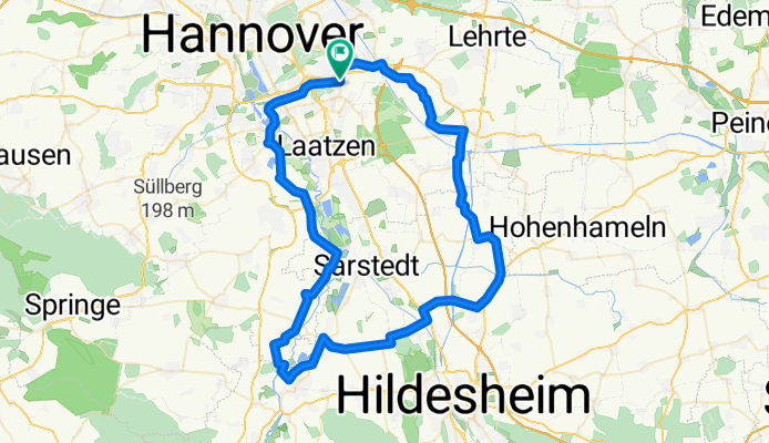
Marienburg-Runde
A cycling route starting in Laatzen, Lower Saxony, Germany.
Overview
About this route
Route:Höver - Bolzum - Algermissen - Harsum - Giesen - Marienburg - Schulenburg - Koldingen - Wilkenburg - Han.-Wülfel
- -:--
- Duration
- 75 km
- Distance
- 190 m
- Ascent
- 190 m
- Descent
- ---
- Avg. speed
- ---
- Max. altitude
Route quality
Waytypes & surfaces along the route
Waytypes
Road
27.8 km
(37 %)
Path
20.3 km
(27 %)
Surfaces
Paved
61.5 km
(82 %)
Asphalt
51 km
(68 %)
Concrete
9 km
(12 %)
Continue with Bikemap
Use, edit, or download this cycling route
You would like to ride Marienburg-Runde or customize it for your own trip? Here is what you can do with this Bikemap route:
Free features
- Save this route as favorite or in collections
- Copy & plan your own version of this route
- Sync your route with Garmin or Wahoo
Premium features
Free trial for 3 days, or one-time payment. More about Bikemap Premium.
- Navigate this route on iOS & Android
- Export a GPX / KML file of this route
- Create your custom printout (try it for free)
- Download this route for offline navigation
Discover more Premium features.
Get Bikemap PremiumFrom our community
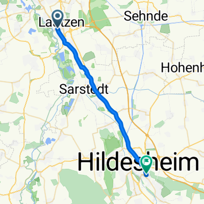
Other popular routes starting in Laatzen
 Laatzen-Hemmingen-Maschsee-Laatzen
- Distance
- 44.3 km
- Ascent
- 93 m
- Descent
- 97 m
- Location
- Laatzen, Lower Saxony, Germany
 Laatzen - Wolfsbergquelle - Hexenhaus
- Distance
- 29.1 km
- Ascent
- 105 m
- Descent
- 102 m
- Location
- Laatzen, Lower Saxony, Germany
 Marienburg-Runde
- Distance
- 75 km
- Ascent
- 190 m
- Descent
- 190 m
- Location
- Laatzen, Lower Saxony, Germany
 Fast bis Hildesheim
- Distance
- 65.1 km
- Ascent
- 200 m
- Descent
- 206 m
- Location
- Laatzen, Lower Saxony, Germany
 Hannover (And.)-Hildesheim-Hannover(And.)
- Distance
- 64.1 km
- Ascent
- 168 m
- Descent
- 161 m
- Location
- Laatzen, Lower Saxony, Germany
 Anderten - Marienburg
- Distance
- 42.4 km
- Ascent
- 159 m
- Descent
- 89 m
- Location
- Laatzen, Lower Saxony, Germany
 Ahornstraße nach Freiherr-vom-Stein-Straße
- Distance
- 22.7 km
- Ascent
- 101 m
- Descent
- 64 m
- Location
- Laatzen, Lower Saxony, Germany
 RRT Hannover - 14.03.11
- Distance
- 136.9 km
- Ascent
- 499 m
- Descent
- 499 m
- Location
- Laatzen, Lower Saxony, Germany
Open it in the app