Francis Scott Key Highway 1610, Keymar to Francis Scott Key Highway 3481, Taneytown
- 8.4 km
- 69 m
- 58 m
- Taneytown, Maryland, United States
<span style="mso-bidi-font-family: "DejaVu Sans Condensed";">Harney is a small town (actually, just a few houses on a four corner intersection) that is about 20 minutes south of </span><span style="mso-bidi-font-family: "DejaVu Sans Condensed";">Gettysburg</span><span style="mso-bidi-font-family: "DejaVu Sans Condensed";"> on Highway 134 (which runs right by the Travel lodge in </span><span style="mso-bidi-font-family: "DejaVu Sans Condensed";">Gettysburg</span><span style="mso-bidi-font-family: "DejaVu Sans Condensed";">!). </span><span style="mso-bidi-font-family: "DejaVu Sans Condensed";"></span>
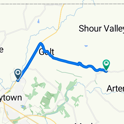
<span style="mso-bidi-font-family: "DejaVu Sans Condensed";">This </span><span style="mso-bidi-font-family: "DejaVu Sans Condensed";">Maryland</span><span style="mso-bidi-font-family: "DejaVu Sans Condensed";"> remote start gets you right into the best </span><span style="mso-bidi-font-family: "DejaVu Sans Condensed";">Maryland</span><span style="mso-bidi-font-family: "DejaVu Sans Condensed";"> has to offer in rolling hills and interesting winding roads following Buffalo Creek and Sam's Creek. </span><span style="mso-bidi-font-family: "DejaVu Sans Condensed";"></span>
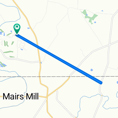
<span style="mso-bidi-font-family: "DejaVu Sans Condensed";">You have lots of options to shorten or extend these two basic loops. In fact, the 70Km Loop is simply the top half of the 102Km loop with a bee-line to </span><span style="mso-bidi-font-family: "DejaVu Sans Condensed";">Union</span><span style="mso-bidi-font-family: "DejaVu Sans Condensed";"> </span><span style="mso-bidi-font-family: "DejaVu Sans Condensed";">Bridge</span><span style="mso-bidi-font-family: "DejaVu Sans Condensed";"> for an early lunch!</span><span style="mso-bidi-font-family: "DejaVu Sans Condensed";"></span> <span style="font-size: 12.0pt; font-family: "Times New Roman"; mso-fareast-font-family: "Times New Roman"; mso-bidi-font-family: "DejaVu Sans Condensed"; mso-ansi-language: EN-US; mso-fareast-language: EN-US;">Note the caution on the steel grate bridge on </span><span style="font-size: 12.0pt; font-family: "Times New Roman"; mso-fareast-font-family: "Times New Roman"; mso-bidi-font-family: "DejaVu Sans Condensed"; mso-ansi-language: EN-US; mso-fareast-language: EN-US;">Harney Road West</span><span style="font-size: 12.0pt; font-family: "Times New Roman"; mso-fareast-font-family: "Times New Roman"; mso-bidi-font-family: "DejaVu Sans Condensed"; mso-ansi-language: EN-US; mso-fareast-language: EN-US;"> of Harney in the cue sheets! We don't take that road because this is a very dangerous bridge for cyclists coming down a steep hill trying to make a hard right turn on the bridge! If you are making up your own route, make a note of that!</span>
Road
66.6 km64 %Quiet road
26 km25 %Paved
43.7 km(42 %)Unpaved
3.1 km(3 %)Asphalt
43.7 km42 %Unpaved (undefined)
3.1 km3 %Undefined
57.2 km55 %Free trial for 3 days, or one-time payment. More about Bikemap Premium.
Discover more Premium features.
Get Bikemap PremiumOpen it in the app