


Felsbastionen Tour
- 56.5 km
- 1,980 m
- 1,981 m
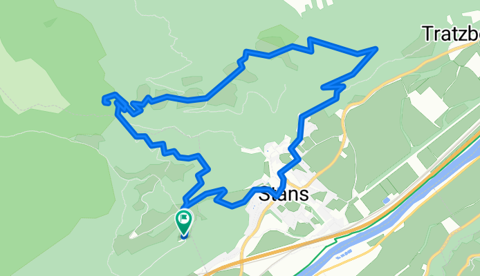
- Stans, Tyrol, Austria
A cycling route starting in Stans, Tyrol, Austria.
Overview
Die Runde beginnt am relativ großen Parkplatz bei Weng / Eggen, etwa 1,3 km nördlich von Fiecht. Man fährt zu Beginn etwa 600 m in nördliche Richtung und zweigt dann rechts ab auf einen sehr steilen Forstweg hinunter nach Stans. Man fährt in östliche Richtung durch Stans durch und weiter hinauf bis zum Spielplatz Heimwald und dann geht es bergauf vorerst in nordöstliche Richtung, später in westliche Richtung nach Kiengufel, weiter zur Roßweide und dann hinunter über die "Hohe Brücke" hinauf nach St. Georgenberg. Nach Einkehr und Wallfahrt fährt man dann auf dem normalen Forstweg in südliche Richtung zurück zum Ausgangspunkt: Parkplatz Weng / Eggen.
created this 4 years ago
Route quality
Track
9.2 km
(83 %)
Quiet road
1.4 km
(13 %)
Paved
6.8 km
(61 %)
Unpaved
4.2 km
(38 %)
Gravel
4.2 km
(38 %)
Asphalt
4 km
(36 %)
Continue with Bikemap
You would like to ride Georgenberg or customize it for your own trip? Here is what you can do with this Bikemap route:
Free trial for 3 days, or one-time payment. More about Bikemap Premium.
Discover more Premium features.
Get Bikemap PremiumFrom our community
Open it in the app


