

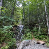
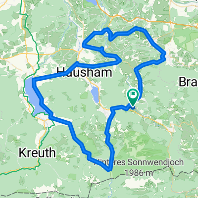
Westliche Kante des Wendelsteins
A cycling route starting in Fischbachau, Bavaria, Germany.
Overview
About this route
The route was actually quite simple (well, as mountain tours tend to be), although we were once again running as if the devil were chasing us. Then the blazing heat made the pavement boil, or us? You couldn’t tell whether your head or your feet were hotter.
- -:--
- Duration
- 20.4 km
- Distance
- 717 m
- Ascent
- 722 m
- Descent
- ---
- Avg. speed
- ---
- Max. altitude

Route highlights
Points of interest along the route
Point of interest after 13.3 km
unglaublich aber wahr, ab dieser Stelle geht es steil nach oben und zwar die Strasse und die Temperatur
Continue with Bikemap
Use, edit, or download this cycling route
You would like to ride Westliche Kante des Wendelsteins or customize it for your own trip? Here is what you can do with this Bikemap route:
Free features
- Save this route as favorite or in collections
- Copy & plan your own version of this route
- Sync your route with Garmin or Wahoo
Premium features
Free trial for 3 days, or one-time payment. More about Bikemap Premium.
- Navigate this route on iOS & Android
- Export a GPX / KML file of this route
- Create your custom printout (try it for free)
- Download this route for offline navigation
Discover more Premium features.
Get Bikemap PremiumFrom our community
Other popular routes starting in Fischbachau
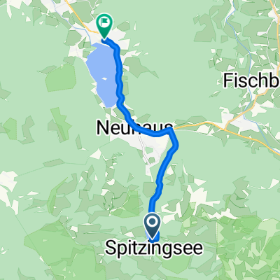
 Spitzingsee - Hammer - Zipflwirt - Valepp - Spitzingsee
- Distance
- 44.4 km
- Ascent
- 737 m
- Descent
- 781 m
- Location
- Fischbachau, Bavaria, Germany
 Von Neuhaus über den Soinsee zum Rotwandhaus
- Distance
- 29.4 km
- Ascent
- 1,013 m
- Descent
- 1,013 m
- Location
- Fischbachau, Bavaria, Germany
 Tegernsee Tour über Bad Feilnbach und Spitzingsee
- Distance
- 87.7 km
- Ascent
- 1,061 m
- Descent
- 1,062 m
- Location
- Fischbachau, Bavaria, Germany
 Schliersee-Tegernsee
- Distance
- 52.8 km
- Ascent
- 962 m
- Descent
- 1,212 m
- Location
- Fischbachau, Bavaria, Germany
 Spitzingsee - Aying
- Distance
- 51.3 km
- Ascent
- 298 m
- Descent
- 779 m
- Location
- Fischbachau, Bavaria, Germany
 08-Jaegerkamp-Schneeschuh
- Distance
- 11.6 km
- Ascent
- 694 m
- Descent
- 697 m
- Location
- Fischbachau, Bavaria, Germany
 Rottach-Spitzing-Sudelfeld-Tatzelwurm-Runde
- Distance
- 114.8 km
- Ascent
- 1,442 m
- Descent
- 1,442 m
- Location
- Fischbachau, Bavaria, Germany
 Seeweg, Schliersee nach Werner-Bochmann-Straße, Schliersee
- Distance
- 10.9 km
- Ascent
- 81 m
- Descent
- 384 m
- Location
- Fischbachau, Bavaria, Germany
Open it in the app