Nesselwang - Mieming
- 74.7 km
- 1,813 m
- 1,828 m
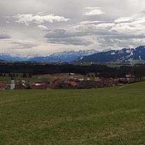
- Nesselwang, Bavaria, Germany
A cycling route starting in Nesselwang, Bavaria, Germany.
Overview
created this 5 years ago


Continue with Bikemap
You would like to ride Nesselwang - Schlossberg-Alm - Schwaltenweiher - Attlesee or customize it for your own trip? Here is what you can do with this Bikemap route:
Free trial for 3 days, or one-time payment. More about Bikemap Premium.
Discover more Premium features.
Get Bikemap PremiumFrom our community
Open it in the app