

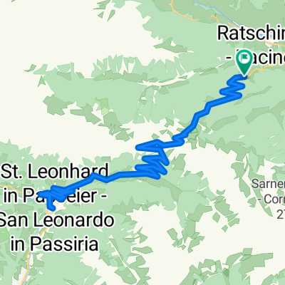
Stange RatschingserHof - Obertelfes - Mareit - Stange
A cycling route starting in Racines - Ratschings, Trentino-Alto Adige, Italy.
Overview
About this route
- -:--
- Duration
- 12.9 km
- Distance
- 358 m
- Ascent
- 289 m
- Descent
- ---
- Avg. speed
- 1,253 m
- Max. altitude
Route quality
Waytypes & surfaces along the route
Waytypes
Road
6.3 km
(49 %)
Track
0.9 km
(7 %)
Surfaces
Paved
7.2 km
(56 %)
Unpaved
0.9 km
(7 %)
Asphalt
7.1 km
(55 %)
Ground
0.9 km
(7 %)
Route highlights
Points of interest along the route
Point of interest after 12.9 km
Stange, Ratschingser Hof
Continue with Bikemap
Use, edit, or download this cycling route
You would like to ride Stange RatschingserHof - Obertelfes - Mareit - Stange or customize it for your own trip? Here is what you can do with this Bikemap route:
Free features
- Save this route as favorite or in collections
- Copy & plan your own version of this route
- Sync your route with Garmin or Wahoo
Premium features
Free trial for 3 days, or one-time payment. More about Bikemap Premium.
- Navigate this route on iOS & Android
- Export a GPX / KML file of this route
- Create your custom printout (try it for free)
- Download this route for offline navigation
Discover more Premium features.
Get Bikemap PremiumFrom our community
Other popular routes starting in Racines - Ratschings
 Jaufenpass
- Distance
- 33.9 km
- Ascent
- 1,051 m
- Descent
- 1,054 m
- Location
- Racines - Ratschings, Trentino-Alto Adige, Italy
 Alpen 2014 - Tag 2
- Distance
- 125 km
- Ascent
- 2,106 m
- Descent
- 1,880 m
- Location
- Racines - Ratschings, Trentino-Alto Adige, Italy
 Jaufenpassrunde
- Distance
- 56.2 km
- Ascent
- 2,018 m
- Descent
- 2,018 m
- Location
- Racines - Ratschings, Trentino-Alto Adige, Italy
 Gasteig - Jaufenpass - Timmelsjoch - Meran
- Distance
- 115.5 km
- Ascent
- 3,191 m
- Descent
- 3,812 m
- Location
- Racines - Ratschings, Trentino-Alto Adige, Italy
 Kalch - Sölden
- Distance
- 80.1 km
- Ascent
- 2,588 m
- Descent
- 2,530 m
- Location
- Racines - Ratschings, Trentino-Alto Adige, Italy
 🚴♀️E*Bike🇮🇩 Sterzing - Tschötsch
- Distance
- 46.1 km
- Ascent
- 186 m
- Descent
- 567 m
- Location
- Racines - Ratschings, Trentino-Alto Adige, Italy
 Trans Alp 2013 - Psycho Cross - Etappe 3
- Distance
- 49.9 km
- Ascent
- 2,297 m
- Descent
- 1,643 m
- Location
- Racines - Ratschings, Trentino-Alto Adige, Italy
 Casateia - Calice - 11
- Distance
- 9.7 km
- Ascent
- 468 m
- Descent
- 479 m
- Location
- Racines - Ratschings, Trentino-Alto Adige, Italy
Open it in the app