

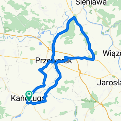
68 km Gminny Szlak Rowerowy "K-ga Max" (Kańczucka pętla)
A cycling route starting in Kańczuga, Subcarpathian Voivodeship, Poland.
Overview
About this route
- -:--
- Duration
- 68.2 km
- Distance
- 710 m
- Ascent
- 715 m
- Descent
- ---
- Avg. speed
- ---
- Max. altitude

Route highlights
Points of interest along the route
Point of interest after 0 km
Start. Park Miejski/Stadion
Point of interest after 0.7 km
Kościół pw.Sw Michała Archanioła XVII w.
Point of interest after 8.3 km
Zródełko św.Antoniego
Point of interest after 10.5 km
Kosciół pw. św Antoniego Padewskiego
Point of interest after 13.6 km
Spalona Baba ( powiązane z legendą z Chodakówki)
Point of interest after 13.7 km
Miejsce Odpoczynku Rowerzystów (MOR 1 ) Dom Seniora/ Dom św. JPII (fundacja "Wzrastanie")
Point of interest after 18.9 km
Średniowieczne grodzisko.
Point of interest after 21 km
Rezerwat Husówka.
Point of interest after 27.2 km
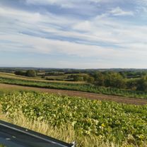
MOR 2. Punkt Widokowy . (?)
Point of interest after 29 km
Cmentarz żydowski.
Point of interest after 30.3 km
Zbiornik retencyjny. Zapora,
Point of interest after 31.2 km
Krzyż . Miejsce pamięci katastrofy lotniczej z 1931 r.
Point of interest after 32.5 km
Kopalnia Alabastru.
Point of interest after 34.4 km
Pomnik rozstrzelanych w 1943 r, przez hitlerowców mieszkańców wsi.
Point of interest after 41.8 km
MOR 3
Point of interest after 46.3 km
Point of interest after 47 km
Pomnik pamięci pomordowanych w 1943 r, przez hitlerowców mieszkańców wsi.
Point of interest after 48.8 km
XVIII w. kapliczka (?)
Point of interest after 53.4 km
Kapliczka św,Antoniego.
Point of interest after 56.5 km
Głaz z tabliczką samolotu.
Point of interest after 56.9 km
Deskal.
Point of interest after 57 km
Tablica pamięci pilota dywizjonu 303 i 308 Waleriana Żaka.
Point of interest after 58.1 km
Drewniany kościół pw. A.Boboli
Point of interest after 58.4 km
Pomnik ofiar wystapień chłopskich z 1936 r.
Point of interest after 58.4 km
Park podworski.
Point of interest after 60 km
Zabytkowa aleja.
Point of interest after 61.5 km
Runy stacyjki kolejki wąskotorowej "Krzeczowice"
Point of interest after 65.2 km
Mogiła wojownika tatarskiego.
Point of interest after 65.5 km
Kościółek . Kapliczka w miejscu spalonego przez Tatarów kościoła.
Point of interest after 66.1 km
XIX wieczny park dworski. Ruiny Pałacu Kellermanów dawnych właścicieli Kańczugi.(własność prywatna)
Point of interest after 66.5 km
Kordegarda.
Point of interest after 66.6 km
Zabytkowa stacyjka kolejki wąskotorowej. Kańczuga,
Point of interest after 68 km
Dawny pałacyk ziemiański Pogonowskich.Obecnie dom dziecka "Fundacja Wzrastanie"
Point of interest after 68.2 km
KOSiR. Teren rekreacyjny nad Zalewem w "Łopuszce Małej" Meta GSR.
Continue with Bikemap
Use, edit, or download this cycling route
You would like to ride 68 km Gminny Szlak Rowerowy "K-ga Max" (Kańczucka pętla) or customize it for your own trip? Here is what you can do with this Bikemap route:
Free features
- Save this route as favorite or in collections
- Copy & plan your own version of this route
- Sync your route with Garmin or Wahoo
Premium features
Free trial for 3 days, or one-time payment. More about Bikemap Premium.
- Navigate this route on iOS & Android
- Export a GPX / KML file of this route
- Create your custom printout (try it for free)
- Download this route for offline navigation
Discover more Premium features.
Get Bikemap PremiumFrom our community
Other popular routes starting in Kańczuga
 65 (64/16) Przeworsk-Tryńcza-Pełkinie-Krzeczowice
- Distance
- 64.6 km
- Ascent
- 134 m
- Descent
- 134 m
- Location
- Kańczuga, Subcarpathian Voivodeship, Poland
 130 (55/16) Rudołowice-Radymno-Wiązownica-Radawa-Sieniawa-Przeworsk
- Distance
- 133.9 km
- Ascent
- 258 m
- Descent
- 260 m
- Location
- Kańczuga, Subcarpathian Voivodeship, Poland
 000(KRA) "Walnijmy setkę" (Koło Rowerowe Axtone) Propozycja 1
- Distance
- 96.1 km
- Ascent
- 556 m
- Descent
- 564 m
- Location
- Kańczuga, Subcarpathian Voivodeship, Poland
 Szkolna do Wolności
- Distance
- 21 km
- Ascent
- 225 m
- Descent
- 276 m
- Location
- Kańczuga, Subcarpathian Voivodeship, Poland
 113/SIENIAWA-KURYŁÓWKA-ŁAŃCUT
- Distance
- 113.4 km
- Ascent
- 261 m
- Descent
- 261 m
- Location
- Kańczuga, Subcarpathian Voivodeship, Poland
 Trasa od bajeczna, kańczuga do bajeczna, kańczuga
- Distance
- 100.1 km
- Ascent
- 563 m
- Descent
- 563 m
- Location
- Kańczuga, Subcarpathian Voivodeship, Poland
 68 km Gminny Szlak Rowerowy "K-ga Max" (Kańczucka pętla)
- Distance
- 68.2 km
- Ascent
- 710 m
- Descent
- 715 m
- Location
- Kańczuga, Subcarpathian Voivodeship, Poland
 75 (19/16) Rożniatów-Jarosław-WÓLKA PEŁKIŃSKA-Tryńcza-Przeworsk
- Distance
- 74.2 km
- Ascent
- 271 m
- Descent
- 271 m
- Location
- Kańczuga, Subcarpathian Voivodeship, Poland
Open it in the app