Childs Ercall to Trailhead Shrewsbury
A cycling route starting in Stoke upon Tern, England, United Kingdom.
Overview
About this route
Country lanes and National Cycle Route 81
- -:--
- Duration
- 32.5 km
- Distance
- 81 m
- Ascent
- 108 m
- Descent
- ---
- Avg. speed
- ---
- Avg. speed
Route quality
Waytypes & surfaces along the route
Waytypes
Quiet road
17 km
(52 %)
Road
6.7 km
(21 %)
Surfaces
Paved
18 km
(55 %)
Unpaved
1.9 km
(6 %)
Asphalt
15.4 km
(47 %)
Paved (undefined)
2.6 km
(8 %)
Continue with Bikemap
Use, edit, or download this cycling route
You would like to ride Childs Ercall to Trailhead Shrewsbury or customize it for your own trip? Here is what you can do with this Bikemap route:
Free features
- Save this route as favorite or in collections
- Copy & plan your own version of this route
- Sync your route with Garmin or Wahoo
Premium features
Free trial for 3 days, or one-time payment. More about Bikemap Premium.
- Navigate this route on iOS & Android
- Export a GPX / KML file of this route
- Create your custom printout (try it for free)
- Download this route for offline navigation
Discover more Premium features.
Get Bikemap PremiumFrom our community
Other popular routes starting in Stoke upon Tern
- First Ride
- Distance
- 7 km
- Ascent
- 34 m
- Descent
- 32 m
- Location
- Stoke upon Tern, England, United Kingdom
- 18 Ternhill Market Drayton - Weaverham
- Distance
- 59.1 km
- Ascent
- 197 m
- Descent
- 234 m
- Location
- Stoke upon Tern, England, United Kingdom
- Childs Ercall to Trailhead Shrewsbury
- Distance
- 32.5 km
- Ascent
- 81 m
- Descent
- 108 m
- Location
- Stoke upon Tern, England, United Kingdom
- Cracking ride in Market Drayton
- Distance
- 23.5 km
- Ascent
- 140 m
- Descent
- 142 m
- Location
- Stoke upon Tern, England, United Kingdom
- Marchamley - Mercian Way - Wem
- Distance
- 45.7 km
- Ascent
- 171 m
- Descent
- 170 m
- Location
- Stoke upon Tern, England, United Kingdom
- Route from Woodlands, Market Drayton
- Distance
- 17.2 km
- Ascent
- 0 m
- Descent
- 23 m
- Location
- Stoke upon Tern, England, United Kingdom
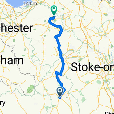
- CE to 4 Alls via Cheswardine
- Distance
- 17.8 km
- Ascent
- 161 m
- Descent
- 121 m
- Location
- Stoke upon Tern, England, United Kingdom
- High-speed route in Market Drayton
- Distance
- 37.4 km
- Ascent
- 158 m
- Descent
- 223 m
- Location
- Stoke upon Tern, England, United Kingdom
Open it in the app