

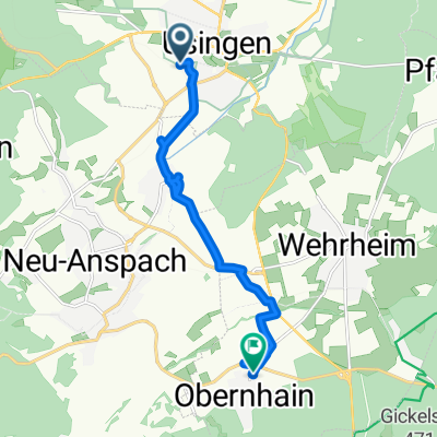
Bartholomäus-Arnoldi-Straße 55A, Usingen nach Bartholomäus-Arnoldi-Straße 55, Usingen
A cycling route starting in Usingen, Hesse, Germany.
Overview
About this route
- 1 h 42 min
- Duration
- 30 km
- Distance
- 363 m
- Ascent
- 366 m
- Descent
- 17.6 km/h
- Avg. speed
- ---
- Max. altitude

Route quality
Waytypes & surfaces along the route
Waytypes
Track
20.7 km
(69 %)
Cycleway
4.8 km
(16 %)
Surfaces
Paved
6.9 km
(23 %)
Unpaved
21.6 km
(72 %)
Gravel
17.4 km
(58 %)
Asphalt
6.9 km
(23 %)
Continue with Bikemap
Use, edit, or download this cycling route
You would like to ride Bartholomäus-Arnoldi-Straße 55A, Usingen nach Bartholomäus-Arnoldi-Straße 55, Usingen or customize it for your own trip? Here is what you can do with this Bikemap route:
Free features
- Save this route as favorite or in collections
- Copy & plan your own version of this route
- Sync your route with Garmin or Wahoo
Premium features
Free trial for 3 days, or one-time payment. More about Bikemap Premium.
- Navigate this route on iOS & Android
- Export a GPX / KML file of this route
- Create your custom printout (try it for free)
- Download this route for offline navigation
Discover more Premium features.
Get Bikemap PremiumFrom our community
Other popular routes starting in Usingen
 Schneefahrt
- Distance
- 17.6 km
- Ascent
- 260 m
- Descent
- 236 m
- Location
- Usingen, Hesse, Germany
 Usingen-Winterstein-Nieder-Mörlen-Usa-Radweg
- Distance
- 40.1 km
- Ascent
- 422 m
- Descent
- 427 m
- Location
- Usingen, Hesse, Germany
 Usingen - Feldberg - Usingen 78 km
- Distance
- 78 km
- Ascent
- 1,658 m
- Descent
- 1,656 m
- Location
- Usingen, Hesse, Germany
 Route in Usingen
- Distance
- 65 km
- Ascent
- 1,462 m
- Descent
- 1,343 m
- Location
- Usingen, Hesse, Germany
 Bahnhofstraße 30, Usingen nach Zur Klingelsmühle 4, Wehrheim
- Distance
- 8.8 km
- Ascent
- 108 m
- Descent
- 54 m
- Location
- Usingen, Hesse, Germany
 Usingen - Bad Nauheim
- Distance
- 18.6 km
- Ascent
- 87 m
- Descent
- 296 m
- Location
- Usingen, Hesse, Germany
 Kinderroute2
- Distance
- 20 km
- Ascent
- 240 m
- Descent
- 247 m
- Location
- Usingen, Hesse, Germany
 Rund um den Winterstein
- Distance
- 35.4 km
- Ascent
- 562 m
- Descent
- 562 m
- Location
- Usingen, Hesse, Germany
Open it in the app