

Radblüten Ingolstadt
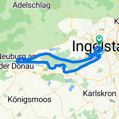
Westschleife: Stadtnaher Auwald entlang von Schutter und Donau
A cycling route starting in Ingolstadt, Bavaria, Germany.
Overview
About this route
Ingolstadt ist eine der grünsten Städte Deutschlands - hätten Sie das gedacht? Eindrucksvoll zeigt sich dies bei einer Radtour durch den Ingolstädter Westen, entlang der beiden Wasseradern Schutter und Donau. Zahlreiche Seen, u.a. die Irgertsheimer Seen und das Naherholungsgebiet Mitterschütt, laden nicht nur zum Erkunden mit dem Rad, sondern im Sommer auch zum Baden und Relaxen ein.
- -:--
- Duration
- 32.2 km
- Distance
- 34 m
- Ascent
- 34 m
- Descent
- ---
- Avg. speed
- ---
- Max. altitude
Part of
4 stages
Route quality
Waytypes & surfaces along the route
Waytypes
Path
16.1 km
(50 %)
Track
9.7 km
(30 %)
Surfaces
Paved
11.9 km
(37 %)
Unpaved
17.1 km
(53 %)
Gravel
12.2 km
(38 %)
Asphalt
11.9 km
(37 %)
Route highlights
Points of interest along the route
Point of interest after 0.6 km
Kreuztor
Point of interest after 2 km
Zoo Wasserstern
Point of interest after 4.2 km
Golfclub Ingolstadt
Point of interest after 14.6 km
Irgertsheiner Seen
Point of interest after 16.2 km
Donaustaustufe Bergheim
Point of interest after 25.5 km
Baggersee / Naherholungsgebiet Mitterschütt
Point of interest after 29.1 km
Donaupavillon
Point of interest after 29.2 km
Donaustaustufe Ingolstadt
Point of interest after 29.7 km
Treidelweg
Continue with Bikemap
Use, edit, or download this cycling route
You would like to ride Westschleife: Stadtnaher Auwald entlang von Schutter und Donau or customize it for your own trip? Here is what you can do with this Bikemap route:
Free features
- Save this route as favorite or in collections
- Copy & plan your own version of this route
- Sync your route with Garmin or Wahoo
Premium features
Free trial for 3 days, or one-time payment. More about Bikemap Premium.
- Navigate this route on iOS & Android
- Export a GPX / KML file of this route
- Create your custom printout (try it for free)
- Download this route for offline navigation
Discover more Premium features.
Get Bikemap PremiumFrom our community
Other popular routes starting in Ingolstadt
 Birkenheide Tour 8/2010
- Distance
- 45.5 km
- Ascent
- 56 m
- Descent
- 56 m
- Location
- Ingolstadt, Bavaria, Germany
 Kurzes Training
- Distance
- 14.8 km
- Ascent
- 12 m
- Descent
- 8 m
- Location
- Ingolstadt, Bavaria, Germany
 Ingolstadt-Eichstätt 1
- Distance
- 26.4 km
- Ascent
- 202 m
- Descent
- 179 m
- Location
- Ingolstadt, Bavaria, Germany
 Neuburgtour 8/2010
- Distance
- 47.7 km
- Ascent
- 61 m
- Descent
- 61 m
- Location
- Ingolstadt, Bavaria, Germany
 Altmühltalrunde
- Distance
- 90.5 km
- Ascent
- 404 m
- Descent
- 402 m
- Location
- Ingolstadt, Bavaria, Germany
 Schmetterlingsweg im Altmühltal
- Distance
- 120 km
- Ascent
- 1,048 m
- Descent
- 1,000 m
- Location
- Ingolstadt, Bavaria, Germany
 Ingolstadt-Wien along the Danube
- Distance
- 548.4 km
- Ascent
- 186 m
- Descent
- 385 m
- Location
- Ingolstadt, Bavaria, Germany
 Ingolstadt-Pfünz-Ingolstadt
- Distance
- 45.2 km
- Ascent
- 290 m
- Descent
- 292 m
- Location
- Ingolstadt, Bavaria, Germany
Open it in the app