

Wollomombi circuit
A cycling route starting in Armidale, New South Wales, Australia.
Overview
About this route
This circuit from Armidale to Wollomombi falls and back via Hillgrove and Bakers creek falls could be undertaken in one longish day. Instead, we chose to take our tent and a barbecue tea and camped out in the National Park. This meant that we not only had a leisurely ride in both directions, but we were able to experience much more of the park. We saw a squirrel glider and a couple of squabbling possums as we cooked our barbecue at Edgars lookout while the sun set colours lit up the sky in one direction and the full moon rose in the other direction. Later we rode our bikes around to the main lookout to photograph the gorge by moonlight, seeing a bonus brush tailed rock wallaby as well as an owl. While eating breakfast we watched and listened to the resident lyrebird displaying. The route is a hilly one, the seal runs out about 7 km along Chandler rd and the road is gravel until Kilcoy rd meets Fassifern rd nearly at Wollomombi village. We returned via Waterfall Way. This is a highway with a fairly low volume of fast traffic. It has a shoulder much of the way, but this is usually very narrow. So, it’s OK to ride but not that pleasant. We took a detour off the main road to visit the old mining village of Hillgrove, as well as Baker’s creek falls. This was mostly a pleasant ride though old Hillgrove rd was pretty corrugated and rough. It also misses one of the narrower sections of the highway.
- -:--
- Duration
- 110.6 km
- Distance
- 1,722 m
- Ascent
- 1,721 m
- Descent
- ---
- Avg. speed
- 1,113 m
- Max. altitude

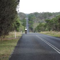
Route photos


Route quality
Waytypes & surfaces along the route
Waytypes
Road
54.4 km
(49 %)
Busy road
28.3 km
(26 %)
Surfaces
Paved
75.1 km
(68 %)
Unpaved
34.2 km
(31 %)
Asphalt
72.2 km
(65 %)
Unpaved (undefined)
32.3 km
(29 %)
Continue with Bikemap
Use, edit, or download this cycling route
You would like to ride Wollomombi circuit or customize it for your own trip? Here is what you can do with this Bikemap route:
Free features
- Save this route as favorite or in collections
- Copy & plan your own version of this route
- Split it into stages to create a multi-day tour
- Sync your route with Garmin or Wahoo
Premium features
Free trial for 3 days, or one-time payment. More about Bikemap Premium.
- Navigate this route on iOS & Android
- Export a GPX / KML file of this route
- Create your custom printout (try it for free)
- Download this route for offline navigation
Discover more Premium features.
Get Bikemap PremiumFrom our community
Other popular routes starting in Armidale
 Apple tree drive loop for kids
- Distance
- 7.8 km
- Ascent
- 92 m
- Descent
- 93 m
- Location
- Armidale, New South Wales, Australia
 Armidale Tourist Information Centre to Dangars Gorge return
- Distance
- 47 km
- Ascent
- 355 m
- Descent
- 353 m
- Location
- Armidale, New South Wales, Australia
 Avoiding the Waterfall Way from Armidale
- Distance
- 92.5 km
- Ascent
- 708 m
- Descent
- 708 m
- Location
- Armidale, New South Wales, Australia
 Armidale to Point Lookout loop
- Distance
- 226.3 km
- Ascent
- 4,225 m
- Descent
- 4,225 m
- Location
- Armidale, New South Wales, Australia
 Kelly's plains circuit
- Distance
- 19.5 km
- Ascent
- 179 m
- Descent
- 179 m
- Location
- Armidale, New South Wales, Australia
 Armidale to Uralla via Hawthorne Dr
- Distance
- 72.4 km
- Ascent
- 463 m
- Descent
- 464 m
- Location
- Armidale, New South Wales, Australia
 Armidale to Gara river crossing along Herbert Park Rd
- Distance
- 48.3 km
- Ascent
- 516 m
- Descent
- 515 m
- Location
- Armidale, New South Wales, Australia
 Armidale, Toms Gully, Puddledock loop
- Distance
- 71.6 km
- Ascent
- 607 m
- Descent
- 607 m
- Location
- Armidale, New South Wales, Australia
Open it in the app