

Radblüten Ingolstadt
Südschleife: Natur, Urbanität und Mobilität in modernem Maßstab
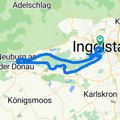
A cycling route starting in Ingolstadt, Bavaria, Germany.
Overview
About this route
Der Süden Ingolstadts erstreckt sich sich halbkreisförmig vom Donau-Stausee und dem urwaldartigen Donau-Auwald der Buschletten über die südlichen Vororte Hundszell, Zuchering, Unterbrunnenreuth und Unsernherrn, bis zum Hauptbahnhof, dem AUDI Sportpark und den beliebten Auwaldsee. Vielfalt Pur also, die sich am besten mit dem Rad erkunden lässt.
- -:--
- Duration
- 32.2 km
- Distance
- 52 m
- Ascent
- 52 m
- Descent
- ---
- Avg. speed
- ---
- Max. altitude
Part of
4 stages
Route quality
Waytypes & surfaces along the route
Waytypes
Path
9.6 km
(30 %)
Track
7.7 km
(24 %)
Surfaces
Paved
15.8 km
(49 %)
Unpaved
12.2 km
(38 %)
Asphalt
15.8 km
(49 %)
Gravel
10 km
(31 %)
Route highlights
Points of interest along the route
Point of interest after 1.3 km
Luitpoldpark
Point of interest after 1.3 km
Altes Messpegelhaus - Kleinstes Museum der Stadt
Point of interest after 4.5 km
Donau-Stausee und Donau-Auwald
Point of interest after 8.6 km
Geotop "Jackl-Brenne"
Point of interest after 12.4 km
Bauerngerätemuseum
Point of interest after 14.6 km
Zucheringer Wald
Point of interest after 20.8 km
Hauptbahnhof Ingolstadt
Point of interest after 25.4 km
AUDI Sportpark
Point of interest after 27.2 km
Auwaldsee
Point of interest after 28 km
Einkehrmöglichkeit Wirtshaus Am Auwaldsee
Point of interest after 31.1 km
Klenzepark
Continue with Bikemap
Use, edit, or download this cycling route
You would like to ride Südschleife: Natur, Urbanität und Mobilität in modernem Maßstab or customize it for your own trip? Here is what you can do with this Bikemap route:
Free features
- Save this route as favorite or in collections
- Copy & plan your own version of this route
- Sync your route with Garmin or Wahoo
Premium features
Free trial for 3 days, or one-time payment. More about Bikemap Premium.
- Navigate this route on iOS & Android
- Export a GPX / KML file of this route
- Create your custom printout (try it for free)
- Download this route for offline navigation
Discover more Premium features.
Get Bikemap PremiumFrom our community
Other popular routes starting in Ingolstadt
 Ingolstadt-Pfünz-Ingolstadt
- Distance
- 45.2 km
- Ascent
- 290 m
- Descent
- 292 m
- Location
- Ingolstadt, Bavaria, Germany
 Kurzes Training
- Distance
- 14.8 km
- Ascent
- 12 m
- Descent
- 8 m
- Location
- Ingolstadt, Bavaria, Germany
 OstRunde - Geisenfeld- Führholzen -Adelsberg
- Distance
- 49.5 km
- Ascent
- 110 m
- Descent
- 112 m
- Location
- Ingolstadt, Bavaria, Germany
 Ingolstadt-Eichstätt 1
- Distance
- 26.4 km
- Ascent
- 202 m
- Descent
- 179 m
- Location
- Ingolstadt, Bavaria, Germany
 Schmetterlingsweg im Altmühltal
- Distance
- 120 km
- Ascent
- 1,048 m
- Descent
- 1,000 m
- Location
- Ingolstadt, Bavaria, Germany
 ingolstadt - münchen
- Distance
- 94.8 km
- Ascent
- 415 m
- Descent
- 294 m
- Location
- Ingolstadt, Bavaria, Germany
 Altmühltalrunde
- Distance
- 90.5 km
- Ascent
- 404 m
- Descent
- 402 m
- Location
- Ingolstadt, Bavaria, Germany
 Neuburgtour 8/2010
- Distance
- 47.7 km
- Ascent
- 61 m
- Descent
- 61 m
- Location
- Ingolstadt, Bavaria, Germany
Open it in the app