

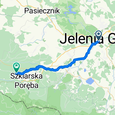
2003.07.04 G. Kaczawskie i Sudety
A cycling route starting in Jelenia Góra, Lower Silesian Voivodeship, Poland.
Overview
About this route
This route is one of the longest and toughest I have ridden. It is the fourth of five sections I have completed to explore the beauty of the Sudetes.
I set off from the PKP station in Jelenia Góra and headed north into the Kaczawskie Mountains. After Dziwiszów, a steep climb begins to the Kapela Pass (600 m above sea level). At the top, I turned left towards Janówek and Czernica. Then I headed towards the Pilchowicki Reservoir on the Bóbr River. Beautiful surroundings and stunning views. I was here in my childhood and wanted to return. After crossing the dam, it turned out that the asphalt had also ended. Now I circled the reservoir on forest paths. I returned to asphalt in the village of Barcinek, then Wrzeszczyn, and through Jeżów Sudecki, I returned to Jelenia Góra. I took a short break here for a meal and to replenish my drinks. The next stage of this trip was the climb through Wojcieszów to Szklarska Poręba (700 m above sea level, Karkonosze). This is part of the international road, so there is heavy traffic and it is dangerous. Now I turned around and descended through Piechowice, Podgórzyn, Miłków for another climb to Karpacz (800 m above sea level). I took a break next to the wooden Wang temple. Then, through the Skalne housing estate, Ściegny to Kowary and another ascent to the Kowary Pass (727 m above sea level, mountains Rudawy Janowickie). Along the way, there is a beautiful view of Kowary. As a reward for the effort, I enjoyed several kilometers of descent to Kamienna Góra and Czarny Bór (Kamienne Mountains). Here I turned right off the main route and reached Boguszów-Gorce. Now for another break, I feel the efforts of the route. Behind the village begins a gentle, long climb to Unisław Śląski. Along the way, I passed the ruins of an evangelical church. Then Rybnica Leśna and a steep descent to Głuszyca. Here the Sowie mountains begin. In Głuszyca, I turned left and around the Jawornik I reached Walim with another ascent, where I finished my excursion exhausted. The route was difficult and heavy, but satisfying. You can visit interesting places and see wonderful views. I reached home in Wrocław the next day. Additionally, I encountered an unpleasant surprise on this route. Somewhere on the outskirts of the Kaczawskie Mountains, between the 24th and 26th kilometers of my excursion, I came across freshly laid asphalt. An empty road. I let go of the bike on the descent. At a speed of 50 km/h, I entered a tree-lined, gentle right-hand curve (this place is only visible on very detailed maps). On the map, on this portal, this road does not exist. Suddenly a surprise. About 50 m ahead, the road sharply turns left onto a small bridge with a stone railing. Quick assessment of the situation. If I don't slow down, I won't fit on the bridge and I will fly about 2 meters over the railing into the rocky, mountain river. I pressed the brakes and felt the back wheel of the bike passing me and at that speed, I landed on the asphalt. I felt my spine drive into my skull. A merciless pain. At the place where I am, the only way out is nonetheless to continue the journey. First stop in Jelenia Góra. The pain allows me to sit only on the saddle. A bruise where my back ends its noble name excludes resting on anything else. The next pause before Karpacz. I turned onto a side road. I laid the bike by the roadside. I myself lay down in the grass. The effect was that drivers stopped and checked if there had been an accident. Upon returning home, it turned out that I had a large hematoma on the back part of my body.
- -:--
- Duration
- 189.6 km
- Distance
- 1,806 m
- Ascent
- 1,676 m
- Descent
- ---
- Avg. speed
- ---
- Max. altitude

Route quality
Waytypes & surfaces along the route
Waytypes
Road
58.8 km
(31 %)
Quiet road
41.7 km
(22 %)
Surfaces
Paved
155.5 km
(82 %)
Unpaved
3.8 km
(2 %)
Asphalt
153.6 km
(81 %)
Paved (undefined)
1.9 km
(1 %)
Continue with Bikemap
Use, edit, or download this cycling route
You would like to ride 2003.07.04 G. Kaczawskie i Sudety or customize it for your own trip? Here is what you can do with this Bikemap route:
Free features
- Save this route as favorite or in collections
- Copy & plan your own version of this route
- Split it into stages to create a multi-day tour
- Sync your route with Garmin or Wahoo
Premium features
Free trial for 3 days, or one-time payment. More about Bikemap Premium.
- Navigate this route on iOS & Android
- Export a GPX / KML file of this route
- Create your custom printout (try it for free)
- Download this route for offline navigation
Discover more Premium features.
Get Bikemap PremiumFrom our community
Other popular routes starting in Jelenia Góra
 2003.07.04 G. Kaczawskie i Sudety
- Distance
- 189.6 km
- Ascent
- 1,806 m
- Descent
- 1,676 m
- Location
- Jelenia Góra, Lower Silesian Voivodeship, Poland
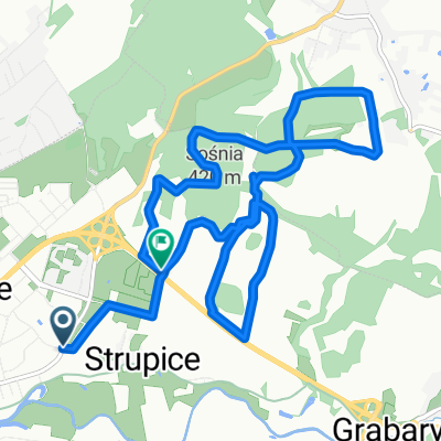 Leśna trasa na ZABOBRZU
- Distance
- 10.8 km
- Ascent
- 177 m
- Descent
- 168 m
- Location
- Jelenia Góra, Lower Silesian Voivodeship, Poland
 Jelenia Góra - Przesieka - Świeradów
- Distance
- 101.7 km
- Ascent
- 1,227 m
- Descent
- 1,227 m
- Location
- Jelenia Góra, Lower Silesian Voivodeship, Poland
 Mała w stronę Miedzianki
- Distance
- 41.1 km
- Ascent
- 263 m
- Descent
- 265 m
- Location
- Jelenia Góra, Lower Silesian Voivodeship, Poland
 Jelenia Gora - Myslakowice
- Distance
- 11.5 km
- Ascent
- 44 m
- Descent
- 11 m
- Location
- Jelenia Góra, Lower Silesian Voivodeship, Poland
 AMPY Jelenia Góra 2013
- Distance
- 4.1 km
- Ascent
- 158 m
- Descent
- 158 m
- Location
- Jelenia Góra, Lower Silesian Voivodeship, Poland
 Route in Świeradów-Zdrój
- Distance
- 23.6 km
- Ascent
- 604 m
- Descent
- 64 m
- Location
- Jelenia Góra, Lower Silesian Voivodeship, Poland
 Rowerem przez polskie góry 2013
- Distance
- 741.9 km
- Ascent
- 3,873 m
- Descent
- 4,022 m
- Location
- Jelenia Góra, Lower Silesian Voivodeship, Poland
Open it in the app