

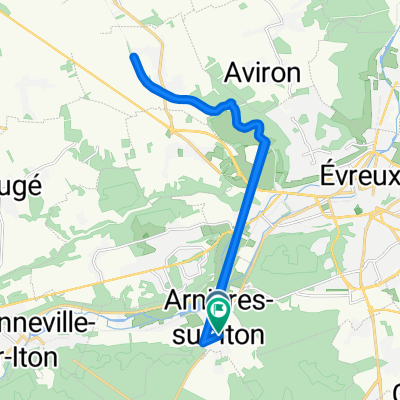
Route stable en Marcilly-la-Campagne
A cycling route starting in Arnières-sur-Iton, Normandy, France.
Overview
About this route
- -:--
- Duration
- 16.6 km
- Distance
- 80 m
- Ascent
- 89 m
- Descent
- ---
- Avg. speed
- ---
- Max. altitude
Route quality
Waytypes & surfaces along the route
Waytypes
Road
14.5 km
(87 %)
Quiet road
0.8 km
(5 %)
Undefined
1.3 km
(8 %)
Surfaces
Paved
2.2 km
(13 %)
Asphalt
2.2 km
(13 %)
Undefined
14.5 km
(87 %)
Continue with Bikemap
Use, edit, or download this cycling route
You would like to ride Route stable en Marcilly-la-Campagne or customize it for your own trip? Here is what you can do with this Bikemap route:
Free features
- Save this route as favorite or in collections
- Copy & plan your own version of this route
- Sync your route with Garmin or Wahoo
Premium features
Free trial for 3 days, or one-time payment. More about Bikemap Premium.
- Navigate this route on iOS & Android
- Export a GPX / KML file of this route
- Create your custom printout (try it for free)
- Download this route for offline navigation
Discover more Premium features.
Get Bikemap PremiumFrom our community
Other popular routes starting in Arnières-sur-Iton
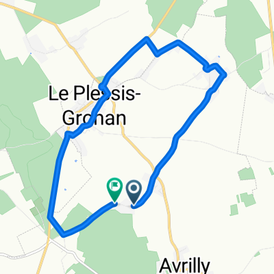
 Itinéraire modéré en Le Plessis-Grohan
- Distance
- 4.1 km
- Ascent
- 40 m
- Descent
- 41 m
- Location
- Arnières-sur-Iton, Normandy, France
 Crisp ride in Marcilly-la-Campagne
- Distance
- 16.1 km
- Ascent
- 29 m
- Descent
- 29 m
- Location
- Arnières-sur-Iton, Normandy, France
 De Chemin du Plessis à Chemin du Plessis
- Distance
- 9.2 km
- Ascent
- 43 m
- Descent
- 46 m
- Location
- Arnières-sur-Iton, Normandy, France
 De Chemin d'Abonnel, Le Plessis-Grohan à 81 Chemin d'Abonnel, Le Plessis-Grohan
- Distance
- 2.8 km
- Ascent
- 20 m
- Descent
- 26 m
- Location
- Arnières-sur-Iton, Normandy, France
 De Chemin des Rabasses à Chemin des Rabasses
- Distance
- 19.7 km
- Ascent
- 90 m
- Descent
- 127 m
- Location
- Arnières-sur-Iton, Normandy, France
 Itinéraire modéré en Le Plessis-Grohan
- Distance
- 5.9 km
- Ascent
- 75 m
- Descent
- 80 m
- Location
- Arnières-sur-Iton, Normandy, France
 Route d'Évreux, Arnières-sur-Iton to Rue des Déportés, Évreux
- Distance
- 4.4 km
- Ascent
- 30 m
- Descent
- 26 m
- Location
- Arnières-sur-Iton, Normandy, France
 Route stable en Marcilly-la-Campagne
- Distance
- 16.6 km
- Ascent
- 80 m
- Descent
- 89 m
- Location
- Arnières-sur-Iton, Normandy, France
Open it in the app