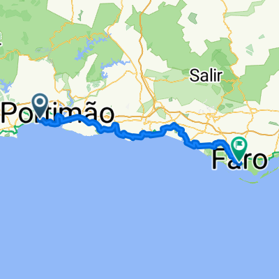
Foia-Runde ab Mexilhoeira Grande
A cycling route starting in Alvor, Faro District, Portugal.
Overview
About this route
Scenic round tour from Mexilhoeira Grande up to Foia (the highest point in the Algarve) and back via Alferce.
All the roads are good for cycling on a road bike, with very little car traffic. There are long, steady climbs as well as short, steep ascents. The last part of the climb and the start of the descent from Foia are on smaller, somewhat steep and bumpy but very picturesque and still quite rideable roads.
At the beginning, you need to pay a little attention to the path, but on most of the route it’s hard to get lost.
Water fountains:
- behind Marmelete (about 1 km?) on the left side of the road
- behind Monchique, a few hundred meters after the turnoff to Alferce on the right side of the road.
Variants:
- Skip Foia (15 km/500 hm less): instead of turning right on the EN501 towards Foia, just stay on the EN501, then follow the signs towards Portimão in Monchique, and later towards Alferce to get back on the route.
- Faster (less scenic) descent from Foia: instead of the small road going east, take the main road west. You will automatically return to the route just before Monchique.
- Flatter ascent: from Monchique, you can also take the EN-266, which is good for cycling but also used by cars for the ascent. For the way to Monchique, see variant 1, then follow the signs towards Foia.
- Alferce: the village center is very nice and worth a short stop!
- -:--
- Duration
- 107.2 km
- Distance
- 1,260 m
- Ascent
- 1,260 m
- Descent
- ---
- Avg. speed
- ---
- Max. altitude
Route quality
Waytypes & surfaces along the route
Waytypes
Road
56.8 km
(53 %)
Quiet road
31.1 km
(29 %)
Surfaces
Paved
46.1 km
(43 %)
Asphalt
46.1 km
(43 %)
Undefined
61.1 km
(57 %)
Continue with Bikemap
Use, edit, or download this cycling route
You would like to ride Foia-Runde ab Mexilhoeira Grande or customize it for your own trip? Here is what you can do with this Bikemap route:
Free features
- Save this route as favorite or in collections
- Copy & plan your own version of this route
- Split it into stages to create a multi-day tour
- Sync your route with Garmin or Wahoo
Premium features
Free trial for 3 days, or one-time payment. More about Bikemap Premium.
- Navigate this route on iOS & Android
- Export a GPX / KML file of this route
- Create your custom printout (try it for free)
- Download this route for offline navigation
Discover more Premium features.
Get Bikemap PremiumFrom our community
Other popular routes starting in Alvor
- Portugalia5
- Distance
- 59.9 km
- Ascent
- 270 m
- Descent
- 265 m
- Location
- Alvor, Faro District, Portugal
- 20 km Vale da Ribeira
- Distance
- 19.1 km
- Ascent
- 249 m
- Descent
- 267 m
- Location
- Alvor, Faro District, Portugal
- Rua Dom Sancho I 18, Alvor nach Rua Dom Sancho I 18, Alvor
- Distance
- 90.3 km
- Ascent
- 4,413 m
- Descent
- 4,425 m
- Location
- Alvor, Faro District, Portugal
- Alvor to Monchique and back
- Distance
- 72 km
- Ascent
- 611 m
- Descent
- 613 m
- Location
- Alvor, Faro District, Portugal
- 20250720 Alvor, Portimao Promenade, PdaRoche, Alvor
- Distance
- 15.1 km
- Ascent
- 125 m
- Descent
- 114 m
- Location
- Alvor, Faro District, Portugal
- Rua Francisco de Bívar 81, Mexilhoeira Grande to Rua das Amoreiras 2–12, Odeceixe
- Distance
- 46.2 km
- Ascent
- 687 m
- Descent
- 715 m
- Location
- Alvor, Faro District, Portugal
- Foia-Runde ab Mexilhoeira Grande
- Distance
- 107.2 km
- Ascent
- 1,260 m
- Descent
- 1,260 m
- Location
- Alvor, Faro District, Portugal
- P Bergetappe nach Alferce
- Distance
- 92.9 km
- Ascent
- 821 m
- Descent
- 821 m
- Location
- Alvor, Faro District, Portugal
Open it in the app