
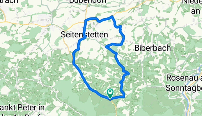
Alpenvorland Radweg-Seitenstetten
A cycling route starting in Biberbach, Lower Austria, Austria.
Overview
About this route
Alpenvorland Radweg-Seitenstetten
- -:--
- Duration
- 16.3 km
- Distance
- 247 m
- Ascent
- 193 m
- Descent
- ---
- Avg. speed
- 463 m
- Max. altitude
Route quality
Waytypes & surfaces along the route
Waytypes
Quiet road
6.7 km
(41 %)
Road
3.9 km
(24 %)
Surfaces
Paved
6.7 km
(41 %)
Unpaved
0.3 km
(2 %)
Asphalt
6.7 km
(41 %)
Ground
0.3 km
(2 %)
Undefined
9.3 km
(57 %)
Continue with Bikemap
Use, edit, or download this cycling route
You would like to ride Alpenvorland Radweg-Seitenstetten or customize it for your own trip? Here is what you can do with this Bikemap route:
Free features
- Save this route as favorite or in collections
- Copy & plan your own version of this route
- Sync your route with Garmin or Wahoo
Premium features
Free trial for 3 days, or one-time payment. More about Bikemap Premium.
- Navigate this route on iOS & Android
- Export a GPX / KML file of this route
- Create your custom printout (try it for free)
- Download this route for offline navigation
Discover more Premium features.
Get Bikemap PremiumFrom our community
Other popular routes starting in Biberbach
 Durchs Ybbstal ins Ötscherland und retour - 1/2
- Distance
- 56.2 km
- Ascent
- 592 m
- Descent
- 350 m
- Location
- Biberbach, Lower Austria, Austria
 Waldesblick 360, Biberbach nach Marktplatz 2, Wallsee
- Distance
- 20.2 km
- Ascent
- 219 m
- Descent
- 295 m
- Location
- Biberbach, Lower Austria, Austria
 WieserHöhe-Voralpenwarte-Hennberg-Kraneweter
- Distance
- 24.2 km
- Ascent
- 678 m
- Descent
- 682 m
- Location
- Biberbach, Lower Austria, Austria
 Bach 191, Biberbach nach Bach 191, Biberbach
- Distance
- 25.4 km
- Ascent
- 717 m
- Descent
- 718 m
- Location
- Biberbach, Lower Austria, Austria
 Bach 191, Biberbach nach Bach 191, Biberbach
- Distance
- 22.2 km
- Ascent
- 338 m
- Descent
- 329 m
- Location
- Biberbach, Lower Austria, Austria
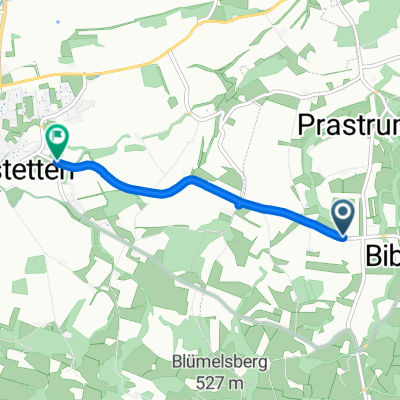 L6204, Biberbach nach Biberbach Straße, Seitenstetten
- Distance
- 3.4 km
- Ascent
- 30 m
- Descent
- 45 m
- Location
- Biberbach, Lower Austria, Austria
 Alpenvorland Radweg-Seitenstetten
- Distance
- 16.3 km
- Ascent
- 247 m
- Descent
- 193 m
- Location
- Biberbach, Lower Austria, Austria
 Bach 191, Biberbach nach Bach 191, Biberbach
- Distance
- 33.3 km
- Ascent
- 816 m
- Descent
- 807 m
- Location
- Biberbach, Lower Austria, Austria
Open it in the app