
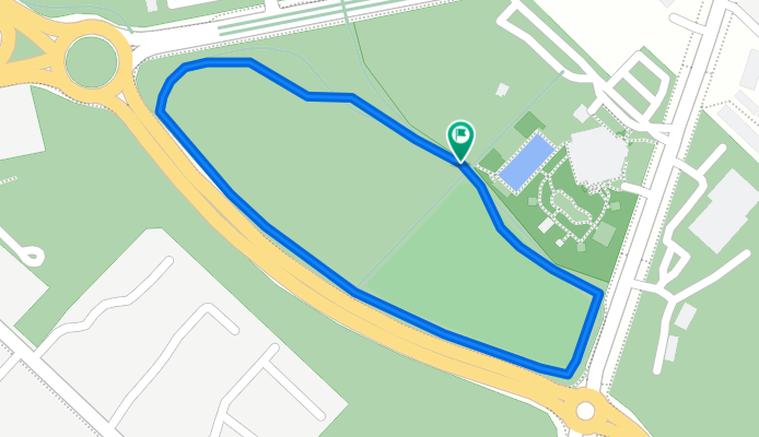
Macquarie Fields Triathlon Track
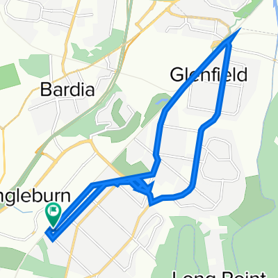
A cycling route starting in Ingleburn, New South Wales, Australia.
Overview
About this route
Although you cannot see the paved road as the map is too old it is a great surface exactly 1 kilometre in length. There is a slight incline on back straight that makes you work.
- -:--
- Duration
- 1 km
- Distance
- 17 m
- Ascent
- 18 m
- Descent
- ---
- Avg. speed
- ---
- Max. altitude
Route quality
Waytypes & surfaces along the route
Waytypes
Cycleway
1 km
(100 %)
Surfaces
Paved
1 km
(100 %)
Asphalt
1 km
(100 %)
Continue with Bikemap
Use, edit, or download this cycling route
You would like to ride Macquarie Fields Triathlon Track or customize it for your own trip? Here is what you can do with this Bikemap route:
Free features
- Save this route as favorite or in collections
- Copy & plan your own version of this route
- Sync your route with Garmin or Wahoo
Premium features
Free trial for 3 days, or one-time payment. More about Bikemap Premium.
- Navigate this route on iOS & Android
- Export a GPX / KML file of this route
- Create your custom printout (try it for free)
- Download this route for offline navigation
Discover more Premium features.
Get Bikemap PremiumFrom our community
Other popular routes starting in Ingleburn
 Ingleburn Road 140 to Ingleburn Road 140
- Distance
- 20.1 km
- Ascent
- 83 m
- Descent
- 114 m
- Location
- Ingleburn, New South Wales, Australia
 26 Gawler Ave, Minto to 26 Gawler Ave, Minto
- Distance
- 6.2 km
- Ascent
- 140 m
- Descent
- 138 m
- Location
- Ingleburn, New South Wales, Australia
 exhausting/hazardous route from ingleburn to wollongong
- Distance
- 61.4 km
- Ascent
- 693 m
- Descent
- 742 m
- Location
- Ingleburn, New South Wales, Australia
 a gentle route from ingleburn to north parramatta
- Distance
- 50.7 km
- Ascent
- 267 m
- Descent
- 284 m
- Location
- Ingleburn, New South Wales, Australia
 136 Ingleburn Rd, Ingleburn to 120C Ingleburn Rd, Ingleburn
- Distance
- 3.3 km
- Ascent
- 27 m
- Descent
- 26 m
- Location
- Ingleburn, New South Wales, Australia
 21 Matthews Square, Ingleburn to 170 Macquarie Street, Liverpool
- Distance
- 12.8 km
- Ascent
- 74 m
- Descent
- 92 m
- Location
- Ingleburn, New South Wales, Australia
 68–70 Oxford Rd, Ingleburn à Eveleigh
- Distance
- 51.7 km
- Ascent
- 325 m
- Descent
- 334 m
- Location
- Ingleburn, New South Wales, Australia
 High-speed route in Liverpool
- Distance
- 10.7 km
- Ascent
- 109 m
- Descent
- 121 m
- Location
- Ingleburn, New South Wales, Australia
Open it in the app