

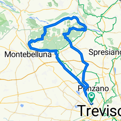
Da Via Alzaia 47d, Treviso a Via Alzaia 13, Treviso
A cycling route starting in Treviso, Veneto, Italy.
Overview
About this route
- 3 h 31 min
- Duration
- 41.1 km
- Distance
- 1,431 m
- Ascent
- 1,386 m
- Descent
- 11.7 km/h
- Avg. speed
- ---
- Max. altitude

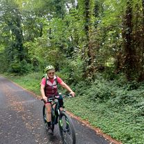
Route photos


Continue with Bikemap
Use, edit, or download this cycling route
You would like to ride Da Via Alzaia 47d, Treviso a Via Alzaia 13, Treviso or customize it for your own trip? Here is what you can do with this Bikemap route:
Free features
- Save this route as favorite or in collections
- Copy & plan your own version of this route
- Sync your route with Garmin or Wahoo
Premium features
Free trial for 3 days, or one-time payment. More about Bikemap Premium.
- Navigate this route on iOS & Android
- Export a GPX / KML file of this route
- Create your custom printout (try it for free)
- Download this route for offline navigation
Discover more Premium features.
Get Bikemap PremiumFrom our community
Other popular routes starting in Treviso
 Girasile: Treviso-Portegrandi ritorno alternativo
- Distance
- 53.9 km
- Ascent
- 65 m
- Descent
- 65 m
- Location
- Treviso, Veneto, Italy
 Viale J. Tasso 1, Treviso to Via Goffredo Mameli 26, Lido di Jesolo
- Distance
- 57.5 km
- Ascent
- 253 m
- Descent
- 267 m
- Location
- Treviso, Veneto, Italy
 Azzano Decimo - Vigodarzere
- Distance
- 149.6 km
- Ascent
- 155 m
- Descent
- 156 m
- Location
- Treviso, Veneto, Italy
 Da Via Sebastiano Venier 51, Treviso a Lungomare Dante Alighieri 8, Punta Sabbioni
- Distance
- 76.8 km
- Ascent
- 287 m
- Descent
- 301 m
- Location
- Treviso, Veneto, Italy
 TV-Bassano-Brenta-rientro ostiglia
- Distance
- 157.7 km
- Ascent
- 1,346 m
- Descent
- 1,346 m
- Location
- Treviso, Veneto, Italy
 Giro 14/05/11
- Distance
- 65.5 km
- Ascent
- 481 m
- Descent
- 481 m
- Location
- Treviso, Veneto, Italy
 Da Treviso a Piazzola sul Brenta e ritorno
- Distance
- 82.4 km
- Ascent
- 332 m
- Descent
- 384 m
- Location
- Treviso, Veneto, Italy
 Treviso - Udine (6° tappa, ultima)
- Distance
- 119.2 km
- Ascent
- 192 m
- Descent
- 98 m
- Location
- Treviso, Veneto, Italy
Open it in the app