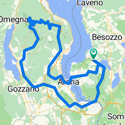
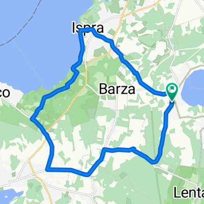
lunch break 2 Santuario di S. Clemente
A cycling route starting in Cadrezzate, Lombardy, Italy.
Overview
About this route
<span style="font-size: 12pt; font-family: "Times New Roman","serif";">Even though the peak is not that high the view to the north from the peak's church </span><span style="font-size: 12pt;" lang="EN-US">on Laveno and Lago Maggiore </span><span style="font-size: 12pt; font-family: "Times New Roman","serif";">is the best in the area. <br /></span>
<span style="font-size: 12pt; font-family: "Times New Roman","serif";">On the top of Monte Sangiano, there is a short flat section which is not paved. I did a few times with my racing bike having slicks on without any problems.</span>
<span style="font-size: 12pt; font-family: "Times New Roman","serif";">The climb at the beginning ant the final top is very steep.</span>
In order to reduce total travel time the the way back leads over the main road (Ispra-Laveno).
<span style="font-size: 10pt; font-family: "Arial","sans-serif";">distance:<span> </span><span> </span></span>25.4<span style="font-size: 10pt; font-family: "Arial","sans-serif";"><span> </span></span><span style="font-size: 10pt; font-family: "Arial","sans-serif";"><span> </span>km</span>
<span style="font-size: 10pt; font-family: "Arial","sans-serif";">time<span> </span><span> </span><span> </span></span>1:28<span style="font-size: 10pt; font-family: "Arial","sans-serif";"><span> </span>h</span>
<span style="font-size: 10pt; font-family: "Arial","sans-serif";">climb<span> </span><span> </span><span> </span></span><span style="font-size: 10pt; font-family: "Arial","sans-serif";">369</span><span style="font-size: 10pt; font-family: "Arial","sans-serif";"><span> </span>meters</span>
<span style="font-size: 10pt; font-family: "Arial","sans-serif";">max elevation <span> </span><span> </span></span><span style="font-size: 10pt; font-family: "Arial","sans-serif";">492</span><span style="font-size: 10pt; font-family: "Arial","sans-serif";"> <span> </span>meters</span>
- -:--
- Duration
- 25.4 km
- Distance
- 357 m
- Ascent
- 360 m
- Descent
- ---
- Avg. speed
- ---
- Max. altitude
Continue with Bikemap
Use, edit, or download this cycling route
You would like to ride lunch break 2 Santuario di S. Clemente or customize it for your own trip? Here is what you can do with this Bikemap route:
Free features
- Save this route as favorite or in collections
- Copy & plan your own version of this route
- Sync your route with Garmin or Wahoo
Premium features
Free trial for 3 days, or one-time payment. More about Bikemap Premium.
- Navigate this route on iOS & Android
- Export a GPX / KML file of this route
- Create your custom printout (try it for free)
- Download this route for offline navigation
Discover more Premium features.
Get Bikemap PremiumFrom our community
Other popular routes starting in Cadrezzate
 Giro del Monte Campo dei Fiori
- Distance
- 67.1 km
- Ascent
- 1,166 m
- Descent
- 1,166 m
- Location
- Cadrezzate, Lombardy, Italy
 Comabbio
- Distance
- 34.6 km
- Ascent
- 268 m
- Descent
- 267 m
- Location
- Cadrezzate, Lombardy, Italy
 Cadreazzate Monvalle Taino
- Distance
- 30.5 km
- Ascent
- 188 m
- Descent
- 170 m
- Location
- Cadrezzate, Lombardy, Italy
 Bike to Malpensa (T1)!!!
- Distance
- 31.3 km
- Ascent
- 214 m
- Descent
- 225 m
- Location
- Cadrezzate, Lombardy, Italy
 Mottarone
- Distance
- 101.6 km
- Ascent
- 1,532 m
- Descent
- 1,532 m
- Location
- Cadrezzate, Lombardy, Italy
 Lunch break 1 Largo di Conabio
- Distance
- 27.9 km
- Ascent
- 255 m
- Descent
- 255 m
- Location
- Cadrezzate, Lombardy, Italy
 15km JRC
- Distance
- 15.6 km
- Ascent
- 153 m
- Descent
- 153 m
- Location
- Cadrezzate, Lombardy, Italy
 Ispra Lugano e ritorno
- Distance
- 88 km
- Ascent
- 726 m
- Descent
- 753 m
- Location
- Cadrezzate, Lombardy, Italy
Open it in the app


