

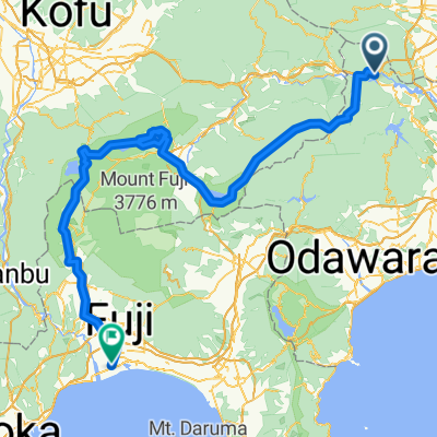
相模湖・富士五湖・朝霧高原
A cycling route starting in Uenohara, Yamanashi, Japan.
Overview
About this route
2006/07/14 19:41:09~2006/07/16 20:49:24
- -:--
- Duration
- 155.1 km
- Distance
- 3,464 m
- Ascent
- 3,651 m
- Descent
- ---
- Avg. speed
- ---
- Max. altitude

Continue with Bikemap
Use, edit, or download this cycling route
You would like to ride 相模湖・富士五湖・朝霧高原 or customize it for your own trip? Here is what you can do with this Bikemap route:
Free features
- Save this route as favorite or in collections
- Copy & plan your own version of this route
- Split it into stages to create a multi-day tour
- Sync your route with Garmin or Wahoo
Premium features
Free trial for 3 days, or one-time payment. More about Bikemap Premium.
- Navigate this route on iOS & Android
- Export a GPX / KML file of this route
- Create your custom printout (try it for free)
- Download this route for offline navigation
Discover more Premium features.
Get Bikemap PremiumFrom our community
Other popular routes starting in Uenohara
 相模湖・富士五湖・朝霧高原
- Distance
- 155.1 km
- Ascent
- 3,464 m
- Descent
- 3,651 m
- Location
- Uenohara, Yamanashi, Japan
 2017 月夜見サイクルマラソン
- Distance
- 62.5 km
- Ascent
- 3,164 m
- Descent
- 3,166 m
- Location
- Uenohara, Yamanashi, Japan
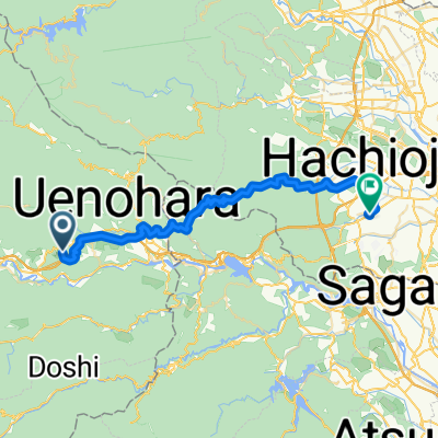 犬目, 上野原市へ東浅川町, 八王子市
- Distance
- 40.9 km
- Ascent
- 1,392 m
- Descent
- 1,707 m
- Location
- Uenohara, Yamanashi, Japan
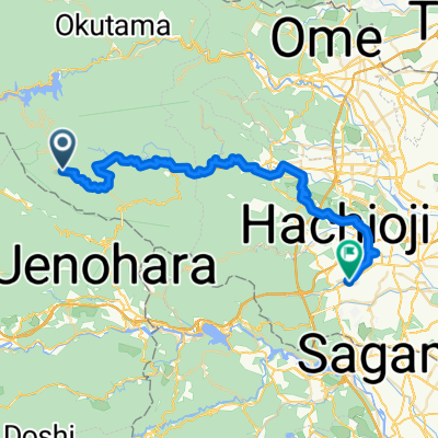 檜原村へ東浅川町, 八王子市
- Distance
- 48.7 km
- Ascent
- 1,995 m
- Descent
- 2,508 m
- Location
- Uenohara, Yamanashi, Japan
 Quick ride from 相模原市 to 八王子市
- Distance
- 4.7 km
- Ascent
- 561 m
- Descent
- 324 m
- Location
- Uenohara, Yamanashi, Japan
 De Sagamihara a 1, Chiyoda City
- Distance
- 68 km
- Ascent
- 764 m
- Descent
- 948 m
- Location
- Uenohara, Yamanashi, Japan
 Sagamihara to 1, Yokohama
- Distance
- 49.8 km
- Ascent
- 277 m
- Descent
- 436 m
- Location
- Uenohara, Yamanashi, Japan
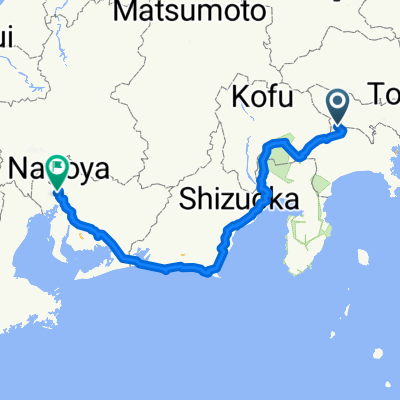 Sagamiko-Nagoya
- Distance
- 412.1 km
- Ascent
- 7,207 m
- Descent
- 7,379 m
- Location
- Uenohara, Yamanashi, Japan
Open it in the app