

Heiden Rundfahrt Variante 2
A cycling route starting in Heiden, Canton of Appenzell Ausserrhoden, Switzerland.
Overview
About this route
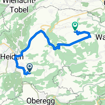
Heiden - Grub - Rehetobel - Oberegg - Walzenhausen - Wolfhalden - Heiden
Nice round trip on asphalted roads with views of Lake Constance and Säntis
- -:--
- Duration
- 31.7 km
- Distance
- 582 m
- Ascent
- 584 m
- Descent
- ---
- Avg. speed
- ---
- Max. altitude
Route quality
Waytypes & surfaces along the route
Waytypes
Road
20.9 km
(66 %)
Quiet road
5.1 km
(16 %)
Surfaces
Paved
12 km
(38 %)
Asphalt
12 km
(38 %)
Undefined
19.6 km
(62 %)
Continue with Bikemap
Use, edit, or download this cycling route
You would like to ride Heiden Rundfahrt Variante 2 or customize it for your own trip? Here is what you can do with this Bikemap route:
Free features
- Save this route as favorite or in collections
- Copy & plan your own version of this route
- Sync your route with Garmin or Wahoo
Premium features
Free trial for 3 days, or one-time payment. More about Bikemap Premium.
- Navigate this route on iOS & Android
- Export a GPX / KML file of this route
- Create your custom printout (try it for free)
- Download this route for offline navigation
Discover more Premium features.
Get Bikemap PremiumFrom our community
Other popular routes starting in Heiden
 Heiden Rundfahrt Variante 1
- Distance
- 14.5 km
- Ascent
- 256 m
- Descent
- 257 m
- Location
- Heiden, Canton of Appenzell Ausserrhoden, Switzerland
 Trogen Surugge
- Distance
- 25.1 km
- Ascent
- 654 m
- Descent
- 647 m
- Location
- Heiden, Canton of Appenzell Ausserrhoden, Switzerland
 Test
Test- Distance
- 0.9 km
- Ascent
- 5 m
- Descent
- 4 m
- Location
- Heiden, Canton of Appenzell Ausserrhoden, Switzerland
 heidennieder
- Distance
- 35.5 km
- Ascent
- 290 m
- Descent
- 606 m
- Location
- Heiden, Canton of Appenzell Ausserrhoden, Switzerland
 Heiden Rundfahrt Variante 2
- Distance
- 31.7 km
- Ascent
- 582 m
- Descent
- 584 m
- Location
- Heiden, Canton of Appenzell Ausserrhoden, Switzerland
 Grub route
- Distance
- 45.2 km
- Ascent
- 619 m
- Descent
- 619 m
- Location
- Heiden, Canton of Appenzell Ausserrhoden, Switzerland
 Heiden nach Lehn 594, Wolfhalden
- Distance
- 7.7 km
- Ascent
- 226 m
- Descent
- 314 m
- Location
- Heiden, Canton of Appenzell Ausserrhoden, Switzerland
 Appenzeller Land
- Distance
- 35.1 km
- Ascent
- 658 m
- Descent
- 567 m
- Location
- Heiden, Canton of Appenzell Ausserrhoden, Switzerland
Open it in the app