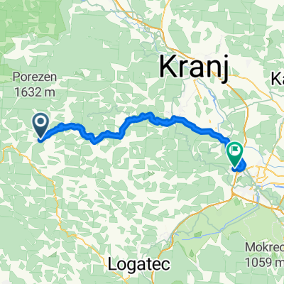
Medvode - Ljubljana
- 61.8 km
- 2,239 m
- 2,249 m
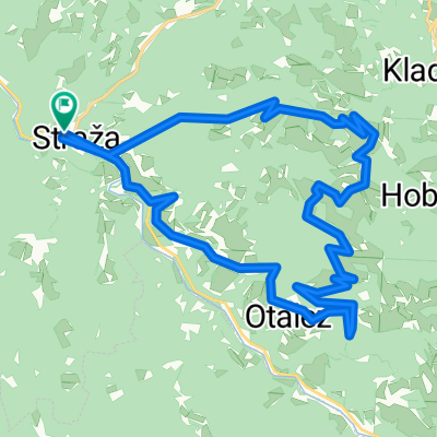
- Cerkno, Cerkno, Slovenia
A cycling route starting in Cerkno, Cerkno, Slovenia.
Overview
created this 14 years ago
Route quality
Quiet road
13.8 km
(69 %)
Track
3 km
(15 %)
Paved
9.2 km
(46 %)
Unpaved
2.4 km
(12 %)
Asphalt
9.2 km
(46 %)
Gravel
1.8 km
(9 %)
Route highlights
Sv. Katarina
Viewpoint
Izvir zaganjalke
Continue with Bikemap
You would like to ride Straža (Želin) - Otalež - Cerkljanski vrh - Zaganjalca - Straža (Želin) or customize it for your own trip? Here is what you can do with this Bikemap route:
Free trial for 3 days, or one-time payment. More about Bikemap Premium.
Discover more Premium features.
Get Bikemap PremiumFrom our community
Open it in the app