

2. Etappe Wörthsee – Murnau
A cycling route starting in Wörthsee, Bavaria, Germany.
Overview
About this route
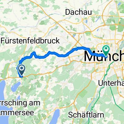
Start: Jakl-Hof Dorfstr. 16, 82237 Steinebach am Wörthsee
Directly along the Wörthsee and Pilsensee first to the Andechs Monastery. Through the Pfaffenwinkel past authentically Bavarian towns – they were given their current appearance by the monks of the surrounding 12 monasteries. Bathing opportunities, besides the Ammersee, also include Lake Staffelsee and Lake Riegsee in Murnau.
Destination: Angerbräu Untermarkt 44, 82418 Murnau /Staffelsee (Bavaria)
- -:--
- Duration
- 56.5 km
- Distance
- 462 m
- Ascent
- 349 m
- Descent
- ---
- Avg. speed
- ---
- Max. altitude
Route quality
Waytypes & surfaces along the route
Waytypes
Quiet road
26.6 km
(47 %)
Track
18.6 km
(33 %)
Surfaces
Paved
35 km
(62 %)
Unpaved
15.3 km
(27 %)
Asphalt
31.6 km
(56 %)
Gravel
11.9 km
(21 %)
Continue with Bikemap
Use, edit, or download this cycling route
You would like to ride 2. Etappe Wörthsee – Murnau or customize it for your own trip? Here is what you can do with this Bikemap route:
Free features
- Save this route as favorite or in collections
- Copy & plan your own version of this route
- Sync your route with Garmin or Wahoo
Premium features
Free trial for 3 days, or one-time payment. More about Bikemap Premium.
- Navigate this route on iOS & Android
- Export a GPX / KML file of this route
- Create your custom printout (try it for free)
- Download this route for offline navigation
Discover more Premium features.
Get Bikemap PremiumFrom our community
Other popular routes starting in Wörthsee
 Wörthsee
- Distance
- 25.3 km
- Ascent
- 3 m
- Descent
- 14 m
- Location
- Wörthsee, Bavaria, Germany
 Schnelle Radrunde durch Wörthsee
- Distance
- 0 km
- Ascent
- 0 m
- Descent
- 0 m
- Location
- Wörthsee, Bavaria, Germany
 Wörthsee - Rotkreutzplatz
- Distance
- 32.8 km
- Ascent
- 88 m
- Descent
- 126 m
- Location
- Wörthsee, Bavaria, Germany
 Wörthseerunde 1
- Distance
- 19.5 km
- Ascent
- 197 m
- Descent
- 200 m
- Location
- Wörthsee, Bavaria, Germany
 Wörthsee Naturlehrpfad
- Distance
- 10.3 km
- Ascent
- 117 m
- Descent
- 120 m
- Location
- Wörthsee, Bavaria, Germany
 Etterschlag München via Blutenburg
- Distance
- 38.4 km
- Ascent
- 96 m
- Descent
- 156 m
- Location
- Wörthsee, Bavaria, Germany
 1. Versuch
- Distance
- 19 km
- Ascent
- 263 m
- Descent
- 255 m
- Location
- Wörthsee, Bavaria, Germany
 Runde Etterschlag Wessling
- Distance
- 11.6 km
- Ascent
- 34 m
- Descent
- 32 m
- Location
- Wörthsee, Bavaria, Germany
Open it in the app