

Santee
A cycling route starting in Eucalyptus Hills, California, United States.
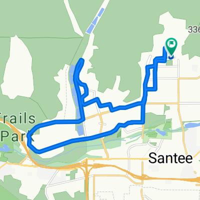
Overview
About this route
- -:--
- Duration
- 13.2 km
- Distance
- 78 m
- Ascent
- 76 m
- Descent
- ---
- Avg. speed
- ---
- Max. altitude
Route quality
Waytypes & surfaces along the route
Waytypes
Quiet road
3 km
(23 %)
Road
2.1 km
(16 %)
Surfaces
Paved
8.2 km
(62 %)
Asphalt
8 km
(61 %)
Concrete
0.1 km
(1 %)
Undefined
5 km
(38 %)
Continue with Bikemap
Use, edit, or download this cycling route
You would like to ride Santee or customize it for your own trip? Here is what you can do with this Bikemap route:
Free features
- Save this route as favorite or in collections
- Copy & plan your own version of this route
- Sync your route with Garmin or Wahoo
Premium features
Free trial for 3 days, or one-time payment. More about Bikemap Premium.
- Navigate this route on iOS & Android
- Export a GPX / KML file of this route
- Create your custom printout (try it for free)
- Download this route for offline navigation
Discover more Premium features.
Get Bikemap PremiumFrom our community
Other popular routes starting in Eucalyptus Hills
 Santee west-north
- Distance
- 20.4 km
- Ascent
- 214 m
- Descent
- 215 m
- Location
- Eucalyptus Hills, California, United States
 11232 Gold Bar Way, Lakeside to Barnett Ave, San Diego
- Distance
- 39.9 km
- Ascent
- 313 m
- Descent
- 445 m
- Location
- Eucalyptus Hills, California, United States
 10225 Kerrigan St, Santee to N Cuyamaca St, Santee
- Distance
- 17.9 km
- Ascent
- 225 m
- Descent
- 203 m
- Location
- Eucalyptus Hills, California, United States
 10241 Princess Sarit Way, Santee to 10610 Esmeraldas Dr, San Diego
- Distance
- 18.8 km
- Ascent
- 254 m
- Descent
- 279 m
- Location
- Eucalyptus Hills, California, United States
 Santee lake
- Distance
- 20.4 km
- Ascent
- 160 m
- Descent
- 154 m
- Location
- Eucalyptus Hills, California, United States
 Santee
- Distance
- 13.2 km
- Ascent
- 78 m
- Descent
- 76 m
- Location
- Eucalyptus Hills, California, United States
 Riverside Drive 11440, Lakeside to Riverford Road 9893, Lakeside
- Distance
- 9.2 km
- Ascent
- 14 m
- Descent
- 14 m
- Location
- Eucalyptus Hills, California, United States
 My Bike Route
- Distance
- 9.7 km
- Ascent
- 77 m
- Descent
- 77 m
- Location
- Eucalyptus Hills, California, United States
Open it in the app