

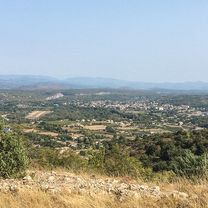
Ardèche J4 - Cols Cx Millet, Cx Bauzon et Meyrand.
A cycling route starting in Ruoms, Auvergne-Rhône-Alpes, France.
Overview
About this route
3
- -:--
- Duration
- 116 km
- Distance
- 1,993 m
- Ascent
- 1,993 m
- Descent
- ---
- Avg. speed
- ---
- Max. altitude
PatBF69
created this 15 years ago
Route quality
Waytypes & surfaces along the route
Waytypes
Road
29 km
25 %
Quiet road
15.1 km
13 %
Surfaces
Paved
34.8 km
(30 %)
Unpaved
4.6 km
(4 %)
Asphalt
31.3 km
27 %
Unpaved (undefined)
4.6 km
4 %
Continue with Bikemap
Use, edit, or download this cycling route
You would like to ride Ardèche J4 - Cols Cx Millet, Cx Bauzon et Meyrand. or customize it for your own trip? Here is what you can do with this Bikemap route:
Free features
- Save this route as favorite or in collections
- Copy & plan your own version of this route
- Split it into stages to create a multi-day tour
- Sync your route with Garmin or Wahoo
Premium features
Free trial for 3 days, or one-time payment. More about Bikemap Premium.
- Navigate this route on iOS & Android
- Export a GPX / KML file of this route
- Create your custom printout (try it for free)
- Download this route for offline navigation
Discover more Premium features.
Get Bikemap PremiumFrom our community
Other popular routes starting in Ruoms


Open it in the app