

FVTC National Trails Day 30 mile Loop Ride 2021
A cycling route starting in Farmington, Connecticut, United States.
Overview
About this route
- -:--
- Duration
- 43.9 km
- Distance
- 183 m
- Ascent
- 177 m
- Descent
- ---
- Avg. speed
- ---
- Max. altitude

Route quality
Waytypes & surfaces along the route
Waytypes
Cycleway
36.2 km
(82 %)
Quiet road
4.1 km
(9 %)
Surfaces
Paved
26.1 km
(59 %)
Unpaved
3.5 km
(8 %)
Asphalt
16.4 km
(37 %)
Paved (undefined)
9.3 km
(21 %)
Route highlights
Points of interest along the route
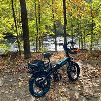
Photo after 0.4 km
Start/Finish at Thompson Rd Trail Parking Lot
Photo after 3.3 km
Preston Reed Bridge across the Farmington River
Photo after 4.6 km
Turn West here for the Farmington River Trail
Photo after 8.1 km
Former Unionville Station
Photo after 10.2 km
Tunnel under CT$/Farmington Ave Unionville
Photo after 15.2 km
Mural at the Collins Axe Co dam
Photo after 16.6 km
Downtown Collinsville has a kiosk, bike racks, water fountain, repair station & more
Photo after 17.3 km
Flower Bridge in Collinsville
Photo after 25 km
Turn into Town Forest & Stratton Brook
Photo after 26.4 km
Covered bridge in Stratton Brook SP
Photo after 31.8 km
OFF ROUTE - a scenic detour (0.5mi) to the Flower Bridge Simsbury & water fountain
Photo after 34.3 km
Bicycle Sculpture
Continue with Bikemap
Use, edit, or download this cycling route
You would like to ride FVTC National Trails Day 30 mile Loop Ride 2021 or customize it for your own trip? Here is what you can do with this Bikemap route:
Free features
- Save this route as favorite or in collections
- Copy & plan your own version of this route
- Sync your route with Garmin or Wahoo
Premium features
Free trial for 3 days, or one-time payment. More about Bikemap Premium.
- Navigate this route on iOS & Android
- Export a GPX / KML file of this route
- Create your custom printout (try it for free)
- Download this route for offline navigation
Discover more Premium features.
Get Bikemap PremiumFrom our community
Other popular routes starting in Farmington
 2020-07-29T12:36:23Z
- Distance
- 40 km
- Ascent
- 654 m
- Descent
- 652 m
- Location
- Farmington, Connecticut, United States
 Farmington Avenue 160 to Brook Street 147, New Britain
- Distance
- 16.4 km
- Ascent
- 65 m
- Descent
- 69 m
- Location
- Farmington, Connecticut, United States
 Pinnacle Rock 200223 from US6
- Distance
- 7.1 km
- Ascent
- 1,056 m
- Descent
- 1,054 m
- Location
- Farmington, Connecticut, United States
 Farmington Canal Heritage Trail North CLONED FROM ROUTE 355802
- Distance
- 163.9 km
- Ascent
- 807 m
- Descent
- 794 m
- Location
- Farmington, Connecticut, United States
 Talcott to Tunxis bikepacking
- Distance
- 54.8 km
- Ascent
- 716 m
- Descent
- 440 m
- Location
- Farmington, Connecticut, United States
 Farmington trail to Collinsville and return via New Road
- Distance
- 26.7 km
- Ascent
- 205 m
- Descent
- 194 m
- Location
- Farmington, Connecticut, United States
 FVTC National Trails Day 30 mile Loop Ride 2021
- Distance
- 43.9 km
- Ascent
- 183 m
- Descent
- 177 m
- Location
- Farmington, Connecticut, United States
 Farmington Woods
- Distance
- 3.5 km
- Ascent
- 83 m
- Descent
- 88 m
- Location
- Farmington, Connecticut, United States
Open it in the app