![[DAY 19] Göschenen - Ilanz](/_next/static/media/contour-lines-light-small.cafd5e5d.avif)
![[DAY 19] Göschenen - Ilanz](https://media.bikemap.net/routes/8561780/staticmaps/in_2c7d3584-57a1-4372-ac45-1c8dc3e2e5a4_694x400_bikemap-2021-3D-static.png)
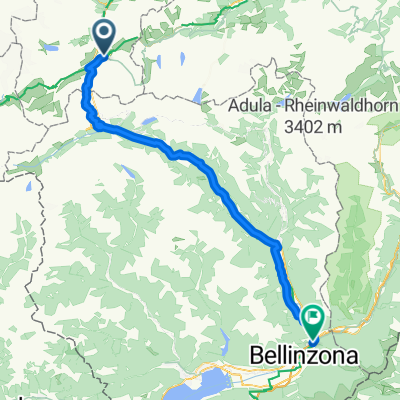
[DAY 19] Göschenen - Ilanz
A cycling route starting in Andermatt, Canton of Uri, Switzerland.
Overview
About this route
- -:--
- Duration
- 68.1 km
- Distance
- 984 m
- Ascent
- 1,380 m
- Descent
- ---
- Avg. speed
- ---
- Max. altitude

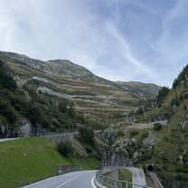
Route photos
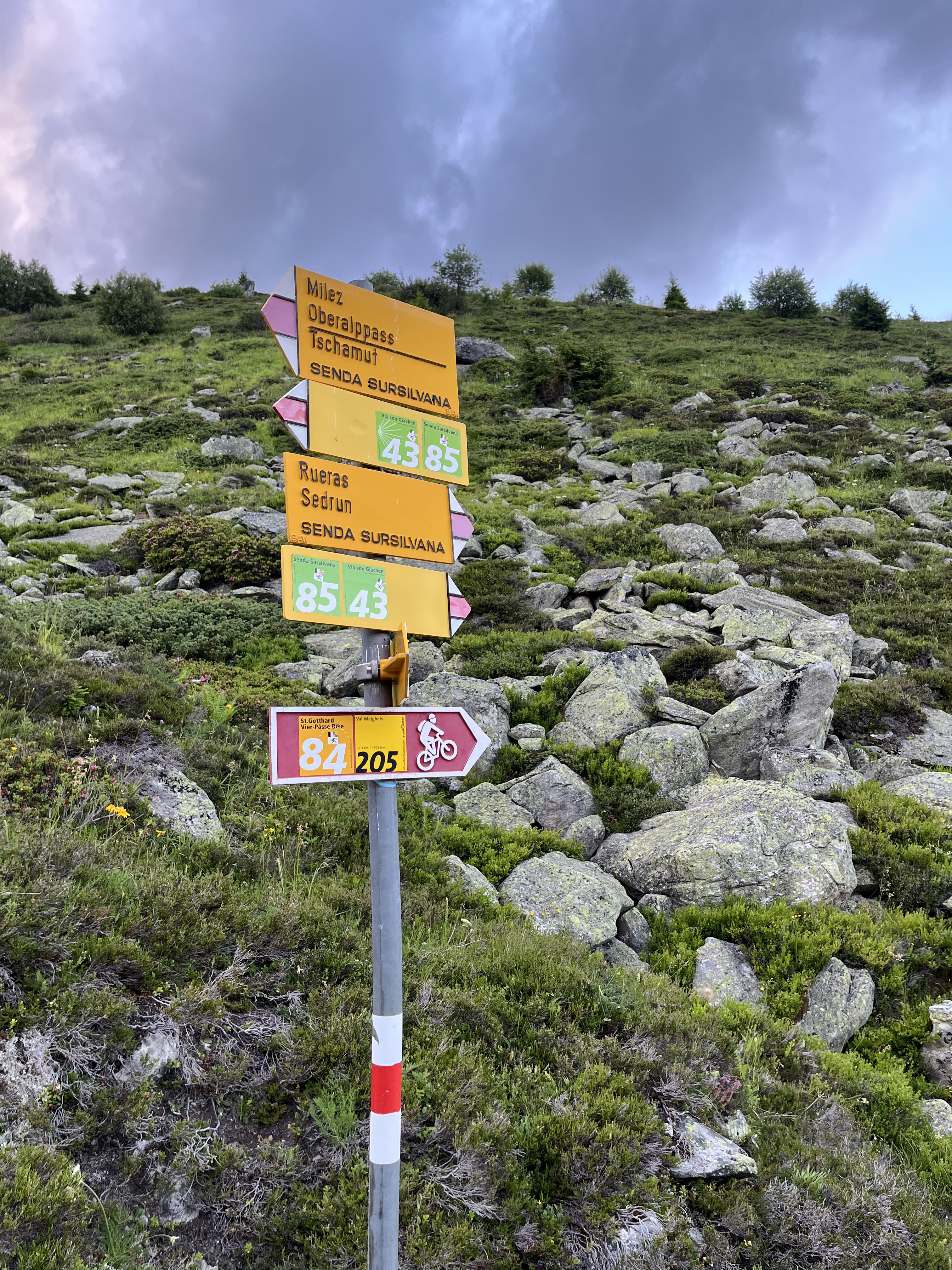
![Photo 1 of the Bikemap route "[DAY 19] Göschenen - Ilanz"](https://media.bikemap.net/routes/8561780/gallery/thumbs/af10c4bc-a85d-4013-8c11-c6c25ccc528a.jpeg.688x400_q80_crop.jpg "Photo 1 of the Bikemap route \"[DAY 19] Göschenen - Ilanz\"")
![Photo 2 of the Bikemap route "[DAY 19] Göschenen - Ilanz"](https://media.bikemap.net/routes/8561780/gallery/thumbs/e2faa872-fbc3-4c2c-b538-870033855a8f.jpeg.688x400_q80_crop.jpg "Photo 2 of the Bikemap route \"[DAY 19] Göschenen - Ilanz\"")
![Photo 3 of the Bikemap route "[DAY 19] Göschenen - Ilanz"](https://media.bikemap.net/routes/8561780/gallery/thumbs/eb5987fc-cb3a-4a38-8faf-3218f15fa9b8.jpeg.208x208_q80_crop.jpg "Photo 3 of the Bikemap route \"[DAY 19] Göschenen - Ilanz\"")
![Photo 4 of the Bikemap route "[DAY 19] Göschenen - Ilanz"](https://media.bikemap.net/routes/8561780/gallery/thumbs/92e0ca0a-6e92-46ec-bb22-be73c500798d.jpeg.208x208_q80_crop.jpg "Photo 4 of the Bikemap route \"[DAY 19] Göschenen - Ilanz\"")
![Photo 5 of the Bikemap route "[DAY 19] Göschenen - Ilanz"](https://media.bikemap.net/routes/8561780/gallery/thumbs/9eabbfb3-ae74-40df-81da-1e663f3f4f7f.jpeg.208x208_q80_crop.jpg "Photo 5 of the Bikemap route \"[DAY 19] Göschenen - Ilanz\"")
![Photo 6 of the Bikemap route "[DAY 19] Göschenen - Ilanz"](https://media.bikemap.net/routes/8561780/gallery/thumbs/34b00172-11bb-4957-ae90-803e64e808ef.jpeg.208x208_q80_crop.jpg "Photo 6 of the Bikemap route \"[DAY 19] Göschenen - Ilanz\"")
![Photo 7 of the Bikemap route "[DAY 19] Göschenen - Ilanz"](https://media.bikemap.net/routes/8561780/gallery/thumbs/ebbaef5e-ba3f-4e42-bdc1-d925829b7329.jpeg.208x208_q80_crop.jpg "Photo 7 of the Bikemap route \"[DAY 19] Göschenen - Ilanz\"")
![Photo 8 of the Bikemap route "[DAY 19] Göschenen - Ilanz"](https://media.bikemap.net/routes/8561780/gallery/thumbs/416dc916-6c23-490a-8d5d-09f5648e4d12.jpeg.208x208_q80_crop.jpg "Photo 8 of the Bikemap route \"[DAY 19] Göschenen - Ilanz\"")
Route quality
Waytypes & surfaces along the route
Waytypes
Track
17.7 km
(26 %)
Quiet road
5.4 km
(8 %)
Surfaces
Paved
51.1 km
(75 %)
Unpaved
17 km
(25 %)
Asphalt
50.4 km
(74 %)
Gravel
15.7 km
(23 %)
Continue with Bikemap
Use, edit, or download this cycling route
You would like to ride [DAY 19] Göschenen - Ilanz or customize it for your own trip? Here is what you can do with this Bikemap route:
Free features
- Save this route as favorite or in collections
- Copy & plan your own version of this route
- Sync your route with Garmin or Wahoo
Premium features
Free trial for 3 days, or one-time payment. More about Bikemap Premium.
- Navigate this route on iOS & Android
- Export a GPX / KML file of this route
- Create your custom printout (try it for free)
- Download this route for offline navigation
Discover more Premium features.
Get Bikemap PremiumFrom our community
Other popular routes starting in Andermatt
 Oberalppass nach Sedrun,Oberalpbike Route 205/84
- Distance
- 17.3 km
- Ascent
- 593 m
- Descent
- 1,193 m
- Location
- Andermatt, Canton of Uri, Switzerland
 VR01 Furkapass Belvedere-Brig.kml - VR01 Furkapass Belvedere-Brig.kml_VR01 Furkapass Belvedere-Brig
- Distance
- 60.1 km
- Ascent
- 852 m
- Descent
- 2,409 m
- Location
- Andermatt, Canton of Uri, Switzerland
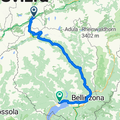
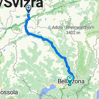 Tag 3: Göschenen - Giubiasco (Bellinzona)
- Distance
- 105.5 km
- Ascent
- 1,280 m
- Descent
- 2,197 m
- Location
- Andermatt, Canton of Uri, Switzerland
 Von Andermatt bis Locarno
- Distance
- 115.9 km
- Ascent
- 2,182 m
- Descent
- 3,407 m
- Location
- Andermatt, Canton of Uri, Switzerland
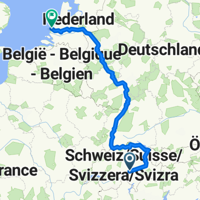 NL The Rhine Cycle Route
- Distance
- 1,352.1 km
- Ascent
- 88 m
- Descent
- 1,523 m
- Location
- Andermatt, Canton of Uri, Switzerland
 Andermatt -Bellinzona Gotthardstrasse to Via San Gottardo
- Distance
- 80.7 km
- Ascent
- 708 m
- Descent
- 1,919 m
- Location
- Andermatt, Canton of Uri, Switzerland
 Furkastrasse, Realp nach Ritystrasse, Brigerbad
- Distance
- 70.6 km
- Ascent
- 558 m
- Descent
- 2,246 m
- Location
- Andermatt, Canton of Uri, Switzerland
 rhein von oberalppass nach hoek van holland
- Distance
- 1,427.3 km
- Ascent
- 146 m
- Descent
- 2,169 m
- Location
- Andermatt, Canton of Uri, Switzerland
Open it in the app