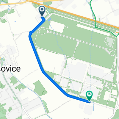
Časovka ArcelorMittal

A cycling route starting in Staré Město, Moravskoslezský kraj, Czechia.

Overview

About this route

0

Start from the building of the Integrated Rescue System on the ring road around the Hyundai car factory in Noszowice, about 1 km east of the village of Dobrá. The route runs around the factory. From this loop, the route turns right over the overpass above the F. Mistek-Czech Tesin highway. At the Nosovice hotel, one enters the main road between Dobrá and Vojkovice. In Vojkovice, after descending into the village, a sharp turn to the right towards Dobratice follows. After a long flat stretch, a climb of about 3 km begins under the highway to the Harenda restaurant already in Vyšních Lhotách. Here, the route turns right, and after a short flat section, a long descent follows, interrupted only by a 'hump' at the water treatment plant in V. Lhoty. At the end of the descent, the riders face a turn on a short flat section. They then complete the previous descent but this time heading upwards to the building of the former Višňovka school. Here, the route sharply turns right towards the Kohutka restaurant and after a short climb, the finish will finally be at the intersection near the aforementioned Kohutka restaurant. Parking and facilities for cyclists will be provided on the grounds of the Na Kamenitém excursion site.

Translated, show original (Polish)
-:--
Duration
17 km
Distance
280 m
Ascent
143 m
Descent
---
Avg. speed
---
Max. altitude
Major
Major

created this 14 years ago

Route quality

Waytypes & surfaces along the route

Route highlights

Points of interest along the route

  1. Highlight 1 along the Bikemap route "Časovka ArcelorMittal"

    Photo after 0 km

    Budova IZS.

  2. Point of interest after 0 km

    Start.

  3. Highlight 3 along the Bikemap route "Časovka ArcelorMittal"

    Photo after 0.1 km

    Rovinka po startu.

  4. Point of interest after 0.4 km

    Kruhový objezd č.1.

  5. Highlight 5 along the Bikemap route "Časovka ArcelorMittal"

    Photo after 0.4 km

    Areál ČEZ.

  6. Highlight 6 along the Bikemap route "Časovka ArcelorMittal"

    Photo after 0.4 km

    Pivovar Radegast.

  7. Point of interest after 0.6 km

    Výjezd a vjezd kamionů do Hyundai.

  8. Highlight 8 along the Bikemap route "Časovka ArcelorMittal"

    Photo after 1 km

    Silnice kolem Hyundai.

  9. Point of interest after 1.5 km

    Výjezd z Hyundai.

  10. Point of interest after 1.7 km

    Výjezd z Hyundai.

  11. Highlight 11 along the Bikemap route "Časovka ArcelorMittal"

    Photo after 1.9 km

    Areál Hyundai.

  12. Point of interest after 1.9 km

    Výjezd z Hyundai.

  13. Point of interest after 2.5 km

    Výjezd z Hyundai.

  14. Point of interest after 2.7 km

    Výjezd od Nošovic.

  15. Point of interest after 2.9 km

    Výjezd od Dobratic.

  16. Point of interest after 3.2 km

    Výjezd od Hyundai.

  17. Point of interest after 3.3 km

    Výjezd od Hyundai.

  18. Point of interest after 3.3 km

  19. Point of interest after 3.5 km

    Výjezd od Hyundai.

  20. Point of interest after 3.9 km

    Kruhový objezd č.2.

  21. Point of interest after 4.5 km

    Nadjezd nad dálnicí F.Místek-Č.Těšín.

  22. Highlight 22 along the Bikemap route "Časovka ArcelorMittal"

    Photo after 4.5 km

    Sjezd z nadjezdu.

  23. Highlight 23 along the Bikemap route "Časovka ArcelorMittal"

    Accommodation after 4.8 km

    Hotel Nošovice.

  24. Point of interest after 5 km

    Auto pořadatelů s majáčkem. Výjezd na hlavní silnici Dobrá-Vojkovice.

  25. Highlight 25 along the Bikemap route "Časovka ArcelorMittal"

    Photo after 5.7 km

    Sjezd do Vojkovic.

  26. Point of interest after 6.6 km

    Odbočka směr Dobratice.

  27. Highlight 27 along the Bikemap route "Časovka ArcelorMittal"

    Photo after 7.2 km

    Silnice směr Dobratice.

  28. Highlight 28 along the Bikemap route "Časovka ArcelorMittal"

    Accommodation after 7.7 km

    Restaurace U koníčka.

  29. Highlight 29 along the Bikemap route "Časovka ArcelorMittal"

    Photo after 7.9 km

    Podjezd pod dálnicí.

  30. Point of interest after 8 km

    Výjezd od zastávky Dobratice.

  31. Point of interest after 8.5 km

    Výjezd u kostela.

  32. Point of interest after 8.6 km

    Výjezd od Hranic.

  33. Highlight 33 along the Bikemap route "Časovka ArcelorMittal"

    Accommodation after 8.9 km

    Restaurace Obecník.

  34. Highlight 34 along the Bikemap route "Časovka ArcelorMittal"

    Photo after 9 km

    Parkoviště před Obecním úřadem Dobratice.

  35. Point of interest after 9 km

    Výjezd od Hranic.

  36. Highlight 36 along the Bikemap route "Časovka ArcelorMittal"

    Photo after 9.1 km

    Stoupání přes Dobratice.

  37. Point of interest after 9.8 km

    Výjezd od Komorní Lhotky

  38. Highlight 38 along the Bikemap route "Časovka ArcelorMittal"

    Photo after 10 km

    Stoupání na konci Dobratic.

  39. Highlight 39 along the Bikemap route "Časovka ArcelorMittal"

    Photo after 10.3 km

    Zhup na silnici směr Harenda.

  40. Point of interest after 10.6 km

    Výjezd od Hranic.

  41. Point of interest after 11 km

    Výjezd od Bukovic.

  42. Highlight 42 along the Bikemap route "Časovka ArcelorMittal"

    Photo after 11 km

    Stoupání k Harendě.

  43. Highlight 43 along the Bikemap route "Časovka ArcelorMittal"

    Accommodation after 11.1 km

    Restaurace Harenda.

  44. Point of interest after 11.2 km

    Výjezd od Komorní Lhotky.

  45. Point of interest after 11.3 km

    Výjezd od Kamenitého.

  46. Highlight 46 along the Bikemap route "Časovka ArcelorMittal"

    Photo after 12.1 km

    Bývalá škola Višňovka.

  47. Highlight 47 along the Bikemap route "Časovka ArcelorMittal"

    Photo after 12.8 km

    Zhup u Úpravny vody.

  48. Highlight 48 along the Bikemap route "Časovka ArcelorMittal"

    Photo after 13.2 km

    Sjezd do Vyšních Lhot.

  49. Point of interest after 13.7 km

    Mostek přes přivaděč vody.

  50. Highlight 50 along the Bikemap route "Časovka ArcelorMittal"

    Photo after 13.8 km

    Rovinka k obrátce ve Vyšních Lhotách.

  51. Point of interest after 14.2 km

    Obrátka.

  52. Point of interest after 14.6 km

    Výjezd u autobusové zastávky.

  53. Highlight 53 along the Bikemap route "Časovka ArcelorMittal"

    Photo after 14.8 km

    Zpáteční stoupání po obrátce směr Višňovka.

  54. Highlight 54 along the Bikemap route "Časovka ArcelorMittal"

    Point of interest after 15.5 km

    Úpravna vody.

  55. Highlight 55 along the Bikemap route "Časovka ArcelorMittal"

    Photo after 16.2 km

    Sjezd k Úpravně vody.

  56. Point of interest after 16.3 km

    Křižovatka u Višňovky.

  57. Highlight 57 along the Bikemap route "Časovka ArcelorMittal"

    Photo after 16.5 km

    Stoupání k cíli u Kohutky.

  58. Highlight 58 along the Bikemap route "Časovka ArcelorMittal"

    Photo after 16.8 km

    Cíl u Kohutky.

  59. Highlight 59 along the Bikemap route "Časovka ArcelorMittal"

    Accommodation after 17 km

    Restaurace Kohutka.

  60. Point of interest after 17 km

    Cíl.

  61. Highlight 61 along the Bikemap route "Časovka ArcelorMittal"

    Drinking water after 17 km

    Parkoviště a zázemí Na Kamenitém.

Continue with Bikemap

Use, edit, or download this cycling route

You would like to ride Časovka ArcelorMittal or customize it for your own trip? Here is what you can do with this Bikemap route:

Free features

Premium features

Free trial for 3 days, or one-time payment. More about Bikemap Premium.

  • Navigate this route on iOS & Android
  • Export a GPX / KML file of this route
  • Create your custom printout (try it for free)
  • Download this route for offline navigation

Discover more Premium features.

Get Bikemap Premium

From our community

Other popular routes starting in Staré Město

Open it in the app