UNESCO Trail
A cycling route starting in Hluboká nad Vltavou, Jihočeský kraj, Czechia.
Overview
About this route
Unesco trail
- -:--
- Duration
- 345.6 km
- Distance
- 1,146 m
- Ascent
- 1,357 m
- Descent
- ---
- Avg. speed
- ---
- Max. altitude
Route quality
Waytypes & surfaces along the route
Waytypes
Road
103.7 km
(30 %)
Track
41.5 km
(12 %)
Surfaces
Paved
159 km
(46 %)
Unpaved
10.4 km
(3 %)
Asphalt
152 km
(44 %)
Paved (undefined)
6.9 km
(2 %)
Route highlights
Points of interest along the route

Point of interest after 0 km
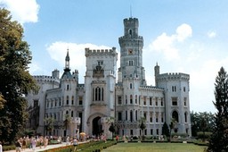
Hluboká nad Vltavou

Point of interest after 3.2 km
Ohrada

Point of interest after 17.1 km
Holasovice UNESCO

Point of interest after 38.3 km
Český Krumlov UNESCO

Point of interest after 41.4 km
Český Krumlov UNESCO

Point of interest after 48.7 km
Zlatá Koruna Monastery

Point of interest after 64.5 km
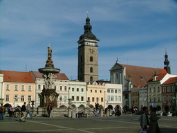
České Budějovice "Budweiser"

Point of interest after 91.3 km
Schwarzenberg Thomb

Point of interest after 95.8 km
Třeboň

Point of interest after 109.6 km
Třeboňsko Biospheric Protected Area

Point of interest after 130.1 km
Nová Bystřice Historical Railway

Point of interest after 144.1 km
Landštejn

Point of interest after 154.4 km
Slavonice

Point of interest after 156.2 km
Slavonice

Point of interest after 175.8 km
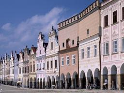
Telč UNESCO

Point of interest after 178.8 km
Telč UNESCO

Point of interest after 214.3 km
Třebíč UNESCO

Point of interest after 218.2 km
Třebíč UNESCO

Point of interest after 219.5 km
Třebíč UNESCO

Point of interest after 229.2 km
Jaroměřice nad Rokytnou

Point of interest after 242.4 km
Jevišovice

Point of interest after 244.6 km
Jevišovice

Point of interest after 255 km
Kravsko

Point of interest after 263.4 km
Znojmo

Point of interest after 264.9 km
Loucký Klášter

Point of interest after 313.2 km
Mikulov

Point of interest after 317.5 km
Mikulov

Point of interest after 328.4 km
Lednice-Valtice UNESCO

Point of interest after 332.4 km
Valtice UNESCO

Point of interest after 340.9 km
Lednice-Valtice UNESCO

Point of interest after 342.6 km
Lednice-Valtice UNESCO

Point of interest after 344.1 km
Lednice UNESCO
Continue with Bikemap
Use, edit, or download this cycling route
You would like to ride UNESCO Trail or customize it for your own trip? Here is what you can do with this Bikemap route:
Free features
- Save this route as favorite or in collections
- Copy & plan your own version of this route
- Split it into stages to create a multi-day tour
- Sync your route with Garmin or Wahoo
Premium features
Free trial for 3 days, or one-time payment. More about Bikemap Premium.
- Navigate this route on iOS & Android
- Export a GPX / KML file of this route
- Create your custom printout (try it for free)
- Download this route for offline navigation
Discover more Premium features.
Get Bikemap PremiumFrom our community
Other popular routes starting in Hluboká nad Vltavou
 Hluboka_trasa_C
- Distance
- 34.3 km
- Ascent
- 683 m
- Descent
- 692 m
- Location
- Hluboká nad Vltavou, Jihočeský kraj, Czechia
 Hluboká n Vlt - Ševětín - Poněšice - Hluboká n Vlt
- Distance
- 37.2 km
- Ascent
- 475 m
- Descent
- 466 m
- Location
- Hluboká nad Vltavou, Jihočeský kraj, Czechia
 Hluboka - Purkarec - retour
- Distance
- 23.9 km
- Ascent
- 345 m
- Descent
- 352 m
- Location
- Hluboká nad Vltavou, Jihočeský kraj, Czechia
 Hluboká nad Vltavou - Třeboň (31 km)
- Distance
- 30.9 km
- Ascent
- 256 m
- Descent
- 225 m
- Location
- Hluboká nad Vltavou, Jihočeský kraj, Czechia
 Hluboka_trasa_B 2025
- Distance
- 52.9 km
- Ascent
- 1,015 m
- Descent
- 1,033 m
- Location
- Hluboká nad Vltavou, Jihočeský kraj, Czechia
 Hluboká ČB a zpět
- Distance
- 20.5 km
- Ascent
- 35 m
- Descent
- 40 m
- Location
- Hluboká nad Vltavou, Jihočeský kraj, Czechia
 Hluboka_trasa_B 2025
- Distance
- 52.9 km
- Ascent
- 1,015 m
- Descent
- 1,033 m
- Location
- Hluboká nad Vltavou, Jihočeský kraj, Czechia
 Hluboka_trasa_TRIP2025B
- Distance
- 29.4 km
- Ascent
- 632 m
- Descent
- 640 m
- Location
- Hluboká nad Vltavou, Jihočeský kraj, Czechia
Open it in the app

