
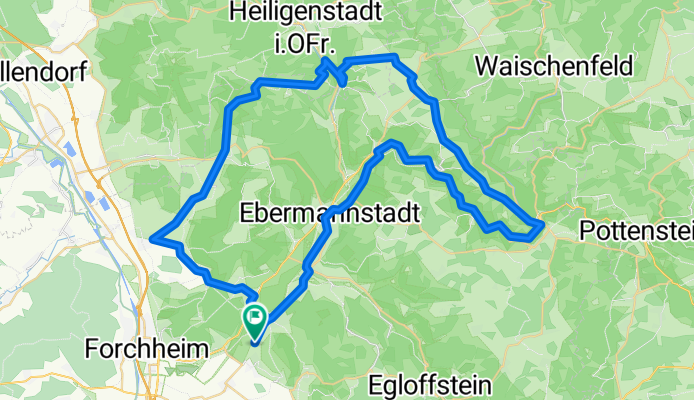
Von Kirchehrenbach über Tiefenstürming in's Wiesenttal
A cycling route starting in Wiesenthau, Bavaria, Germany.
Overview
About this route
Nice road tour via Eggolsheim and Tiefenstürmig, returning over the heights into the Wiesent valley, from there a section on the B470 to Streitberg, then back on a smaller road.
- -:--
- Duration
- 67.6 km
- Distance
- 615 m
- Ascent
- 614 m
- Descent
- ---
- Avg. speed
- ---
- Max. altitude
Continue with Bikemap
Use, edit, or download this cycling route
You would like to ride Von Kirchehrenbach über Tiefenstürming in's Wiesenttal or customize it for your own trip? Here is what you can do with this Bikemap route:
Free features
- Save this route as favorite or in collections
- Copy & plan your own version of this route
- Sync your route with Garmin or Wahoo
Premium features
Free trial for 3 days, or one-time payment. More about Bikemap Premium.
- Navigate this route on iOS & Android
- Export a GPX / KML file of this route
- Create your custom printout (try it for free)
- Download this route for offline navigation
Discover more Premium features.
Get Bikemap PremiumFrom our community
Other popular routes starting in Wiesenthau
 Fränkische Schweiz ab Forchheim - Reuth
- Distance
- 51.2 km
- Ascent
- 731 m
- Descent
- 613 m
- Location
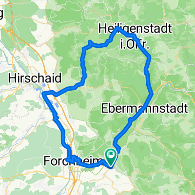
- Wiesenthau, Bavaria, Germany
 Feierabendrunde
- Distance
- 41.2 km
- Ascent
- 354 m
- Descent
- 336 m
- Location
- Wiesenthau, Bavaria, Germany
 eine schöne kleine runde durch die fränkische CLONED FROM ROUTE 261440
- Distance
- 64.2 km
- Ascent
- 943 m
- Descent
- 943 m
- Location
- Wiesenthau, Bavaria, Germany
 Rundtour Wiesenthau - Glückstadt - Hirschaid
- Distance
- 61.1 km
- Ascent
- 334 m
- Descent
- 325 m
- Location
- Wiesenthau, Bavaria, Germany
 FaC Rund ums Waberla
- Distance
- 9.5 km
- Ascent
- 107 m
- Descent
- 44 m
- Location
- Wiesenthau, Bavaria, Germany
 After Work Sonnenuntergangstour
- Distance
- 9.5 km
- Ascent
- 284 m
- Descent
- 273 m
- Location
- Wiesenthau, Bavaria, Germany
 Von Kirchehrenbach über Tiefenstürming in's Wiesenttal
- Distance
- 67.6 km
- Ascent
- 615 m
- Descent
- 614 m
- Location
- Wiesenthau, Bavaria, Germany
 Mühlenhof - Pretzfeld - Ebermannstadt - Mühlenhof
- Distance
- 19.5 km
- Ascent
- 65 m
- Descent
- 59 m
- Location
- Wiesenthau, Bavaria, Germany
Open it in the app