Tappa 2: Vicenza - Chioggia (Ciclovia I1/I2 EV8)
A cycling route starting in Arcugnano, Veneto, Italy.
Overview
About this route
The bike path runs alongside the Bacchiglione River up to Padua. From Padua, it follows the I1/I2 bike route until it meets the Bacchiglione again in Bovolenta, where it will accompany it all the way to the lagoon.
- -:--
- Duration
- 96.5 km
- Distance
- 14 m
- Ascent
- 45 m
- Descent
- ---
- Avg. speed
- 35 m
- Max. altitude
Route quality
Waytypes & surfaces along the route
Waytypes
Quiet road
39.6 km
(41 %)
Path
25.1 km
(26 %)
Surfaces
Paved
77.2 km
(80 %)
Unpaved
12.5 km
(13 %)
Asphalt
75.2 km
(78 %)
Loose gravel
10.6 km
(11 %)
Route highlights
Points of interest along the route

Point of interest after 22.4 km
Castello di San Martino della Vaneza, si trova lungo l'argine del fiume Bacchiglione che fin dall'antichità ha rappresentato prima un importante centro strategico di difesa militare, poi un rinomato riferimento per il traffico mercantile.
Continue with Bikemap
Use, edit, or download this cycling route
You would like to ride Tappa 2: Vicenza - Chioggia (Ciclovia I1/I2 EV8) or customize it for your own trip? Here is what you can do with this Bikemap route:
Free features
- Save this route as favorite or in collections
- Copy & plan your own version of this route
- Split it into stages to create a multi-day tour
- Sync your route with Garmin or Wahoo
Premium features
Free trial for 3 days, or one-time payment. More about Bikemap Premium.
- Navigate this route on iOS & Android
- Export a GPX / KML file of this route
- Create your custom printout (try it for free)
- Download this route for offline navigation
Discover more Premium features.
Get Bikemap PremiumFrom our community
Other popular routes starting in Arcugnano
VENETO_138_3550_BERICI- Distance
- 118.2 km
- Ascent
- 2,860 m
- Descent
- 2,861 m
- Location
- Arcugnano, Veneto, Italy
Torri-Marostica-Bassano-Torri- Distance
- 85.7 km
- Ascent
- 119 m
- Descent
- 120 m
- Location
- Arcugnano, Veneto, Italy
Fimon - Monte Berico- Distance
- 31.2 km
- Ascent
- 399 m
- Descent
- 401 m
- Location
- Arcugnano, Veneto, Italy
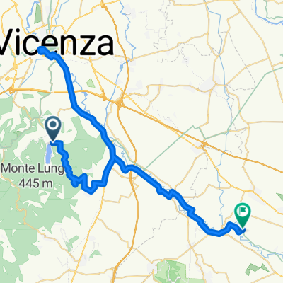
Arcugnano - Saccolongo- Distance
- 53.3 km
- Ascent
- 505 m
- Descent
- 515 m
- Location
- Arcugnano, Veneto, Italy
Short_Trip_Berici- Distance
- 17.6 km
- Ascent
- 629 m
- Descent
- 495 m
- Location
- Arcugnano, Veneto, Italy
Alta Via Dei Berici 2021- Distance
- 130.1 km
- Ascent
- 4,213 m
- Descent
- 4,210 m
- Location
- Arcugnano, Veneto, Italy
Berici- Distance
- 89.7 km
- Ascent
- 1,138 m
- Descent
- 1,097 m
- Location
- Arcugnano, Veneto, Italy
Arcugnano 17km 310md+- Distance
- 17.2 km
- Ascent
- 391 m
- Descent
- 394 m
- Location
- Arcugnano, Veneto, Italy
Open it in the app


