

Roadbike Tour 1
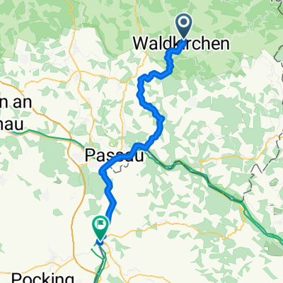
A cycling route starting in Waldkirchen, Bavaria, Germany.
Overview
About this route
Vorschlag aus Roadbike
Will sie im Juni fahren
- -:--
- Duration
- 104.6 km
- Distance
- 1,063 m
- Ascent
- 1,063 m
- Descent
- ---
- Avg. speed
- ---
- Max. altitude
Continue with Bikemap
Use, edit, or download this cycling route
You would like to ride Roadbike Tour 1 or customize it for your own trip? Here is what you can do with this Bikemap route:
Free features
- Save this route as favorite or in collections
- Copy & plan your own version of this route
- Split it into stages to create a multi-day tour
- Sync your route with Garmin or Wahoo
Premium features
Free trial for 3 days, or one-time payment. More about Bikemap Premium.
- Navigate this route on iOS & Android
- Export a GPX / KML file of this route
- Create your custom printout (try it for free)
- Download this route for offline navigation
Discover more Premium features.
Get Bikemap PremiumFrom our community
Other popular routes starting in Waldkirchen
 Waldkirchen nach Schärding
- Distance
- 51.3 km
- Ascent
- 673 m
- Descent
- 862 m
- Location
- Waldkirchen, Bavaria, Germany
 Waldkirchen-Haidel
- Distance
- 49.7 km
- Ascent
- 748 m
- Descent
- 748 m
- Location
- Waldkirchen, Bavaria, Germany
 Adalbert - Stifter - Radweg
- Distance
- 61.5 km
- Ascent
- 1,005 m
- Descent
- 1,004 m
- Location
- Waldkirchen, Bavaria, Germany
 Roadbike Tour 1
- Distance
- 104.6 km
- Ascent
- 1,063 m
- Descent
- 1,063 m
- Location
- Waldkirchen, Bavaria, Germany
 osterbachtal-Tour Nr.1
- Distance
- 22 km
- Ascent
- 329 m
- Descent
- 331 m
- Location
- Waldkirchen, Bavaria, Germany
 Genussradweg von Waldkirchen
- Distance
- 199.3 km
- Ascent
- 1,736 m
- Descent
- 1,740 m
- Location
- Waldkirchen, Bavaria, Germany
 BayerischerWald_Waldkirchen
- Distance
- 97.8 km
- Ascent
- 895 m
- Descent
- 903 m
- Location
- Waldkirchen, Bavaria, Germany
 E4 NEU-2015: Oberhöhenstetten-Novo Udoli Bahnhof
- Distance
- 33.4 km
- Ascent
- 482 m
- Descent
- 237 m
- Location
- Waldkirchen, Bavaria, Germany
Open it in the app