

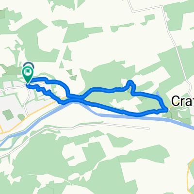
Scoltie hill, Banchory
A cycling route starting in Banchory, Scotland, United Kingdom.
Overview
About this route
- 38 min
- Duration
- 38.9 km
- Distance
- 98 m
- Ascent
- 22 m
- Descent
- 60.9 km/h
- Avg. speed
- ---
- Max. altitude

Route quality
Waytypes & surfaces along the route
Waytypes
Quiet road
16.4 km
(42 %)
Cycleway
10.5 km
(27 %)
Surfaces
Paved
12.8 km
(33 %)
Unpaved
6.6 km
(17 %)
Asphalt
12.8 km
(33 %)
Unpaved (undefined)
5.5 km
(14 %)
Continue with Bikemap
Use, edit, or download this cycling route
You would like to ride Scoltie hill, Banchory or customize it for your own trip? Here is what you can do with this Bikemap route:
Free features
- Save this route as favorite or in collections
- Copy & plan your own version of this route
- Sync your route with Garmin or Wahoo
Premium features
Free trial for 3 days, or one-time payment. More about Bikemap Premium.
- Navigate this route on iOS & Android
- Export a GPX / KML file of this route
- Create your custom printout (try it for free)
- Download this route for offline navigation
Discover more Premium features.
Get Bikemap PremiumFrom our community
Other popular routes starting in Banchory
 Windmill Route
- Distance
- 47.4 km
- Ascent
- 825 m
- Descent
- 823 m
- Location
- Banchory, Scotland, United Kingdom
 Short bike tour through Banchory
- Distance
- 7.9 km
- Ascent
- 90 m
- Descent
- 84 m
- Location
- Banchory, Scotland, United Kingdom
 High Street 34 to Station Square
- Distance
- 41.8 km
- Ascent
- 506 m
- Descent
- 369 m
- Location
- Banchory, Scotland, United Kingdom
 Slug Road
- Distance
- 3.3 km
- Ascent
- 131 m
- Descent
- 0 m
- Location
- Banchory, Scotland, United Kingdom
 Carn O Mount
- Distance
- 34.5 km
- Ascent
- 826 m
- Descent
- 825 m
- Location
- Banchory, Scotland, United Kingdom
 40K Through Durris and Drumoak
- Distance
- 40.4 km
- Ascent
- 519 m
- Descent
- 519 m
- Location
- Banchory, Scotland, United Kingdom
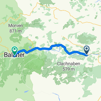 Banchory - Aboyne - Ballater
- Distance
- 38.9 km
- Ascent
- 273 m
- Descent
- 136 m
- Location
- Banchory, Scotland, United Kingdom
 B976, Strachan, Banchory to Glenbervie Road, Aberdeenshire
- Distance
- 29.2 km
- Ascent
- 670 m
- Descent
- 640 m
- Location
- Banchory, Scotland, United Kingdom
Open it in the app