

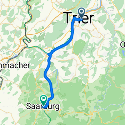
£-2 Trier - Bernkastel Et.1 tot Römer Villa Mehring
A cycling route starting in Trier, Rhineland-Palatinate, Germany.
Overview
About this route
- -:--
- Duration
- 21.2 km
- Distance
- 138 m
- Ascent
- 134 m
- Descent
- ---
- Avg. speed
- ---
- Max. altitude

Route quality
Waytypes & surfaces along the route
Waytypes
Path
12.5 km
(59 %)
Quiet road
3.3 km
(16 %)
Surfaces
Paved
20.3 km
(96 %)
Asphalt
19.1 km
(90 %)
Paved (undefined)
0.6 km
(3 %)
Route highlights
Points of interest along the route
Point of interest after 0.4 km
Karl Marx Haus
Point of interest after 1.4 km
Porta Nigra
Point of interest after 13.1 km
Opgelet: gevaarlijke bocht. Weg oversteken onder de brug naar Schweich de rechter oever verder volgen
Point of interest after 20.8 km
Hotel Alt-Kues
Continue with Bikemap
Use, edit, or download this cycling route
You would like to ride £-2 Trier - Bernkastel Et.1 tot Römer Villa Mehring or customize it for your own trip? Here is what you can do with this Bikemap route:
Free features
- Save this route as favorite or in collections
- Copy & plan your own version of this route
- Sync your route with Garmin or Wahoo
Premium features
Free trial for 3 days, or one-time payment. More about Bikemap Premium.
- Navigate this route on iOS & Android
- Export a GPX / KML file of this route
- Create your custom printout (try it for free)
- Download this route for offline navigation
Discover more Premium features.
Get Bikemap PremiumFrom our community
Other popular routes starting in Trier
 Trier-Mariahof-Roscheid und zurück
- Distance
- 28.2 km
- Ascent
- 365 m
- Descent
- 297 m
- Location
- Trier, Rhineland-Palatinate, Germany
 Moselradweg
- Distance
- 150 km
- Ascent
- 792 m
- Descent
- 851 m
- Location
- Trier, Rhineland-Palatinate, Germany
 Mosel-Radweg:
- Distance
- 193.9 km
- Ascent
- 393 m
- Descent
- 461 m
- Location
- Trier, Rhineland-Palatinate, Germany
 Trier - Bernkastel
- Distance
- 66 km
- Ascent
- 182 m
- Descent
- 220 m
- Location
- Trier, Rhineland-Palatinate, Germany
 Tour der Leiden ;-)
- Distance
- 90.5 km
- Ascent
- 1,226 m
- Descent
- 1,037 m
- Location
- Trier, Rhineland-Palatinate, Germany
 2. Etappe - Graf-Siegfried-Straße, Saarburg nach Heinertstraße, Mettlach
- Distance
- 24.3 km
- Ascent
- 166 m
- Descent
- 139 m
- Location
- Trier, Rhineland-Palatinate, Germany
 Trier - Ehrang - Euren - Trier
- Distance
- 34.9 km
- Ascent
- 506 m
- Descent
- 508 m
- Location
- Trier, Rhineland-Palatinate, Germany
 Trier - Koblenz
- Distance
- 190.9 km
- Ascent
- 267 m
- Descent
- 331 m
- Location
- Trier, Rhineland-Palatinate, Germany
Open it in the app