

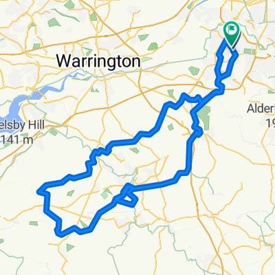
60km Circular Route
A cycling route starting in Timperley, England, United Kingdom.
Overview
About this route
- 2 h 22 min
- Duration
- 61.3 km
- Distance
- 297 m
- Ascent
- 295 m
- Descent
- 25.8 km/h
- Avg. speed
- ---
- Max. altitude

Route quality
Waytypes & surfaces along the route
Waytypes
Road
25.2 km
(41 %)
Busy road
22.5 km
(37 %)
Surfaces
Paved
18.2 km
(30 %)
Asphalt
17.8 km
(29 %)
Paved (undefined)
0.3 km
(<1 %)
Undefined
43.1 km
(70 %)
Continue with Bikemap
Use, edit, or download this cycling route
You would like to ride 60km Circular Route or customize it for your own trip? Here is what you can do with this Bikemap route:
Free features
- Save this route as favorite or in collections
- Copy & plan your own version of this route
- Sync your route with Garmin or Wahoo
Premium features
Free trial for 3 days, or one-time payment. More about Bikemap Premium.
- Navigate this route on iOS & Android
- Export a GPX / KML file of this route
- Create your custom printout (try it for free)
- Download this route for offline navigation
Discover more Premium features.
Get Bikemap PremiumFrom our community
Other popular routes starting in Timperley
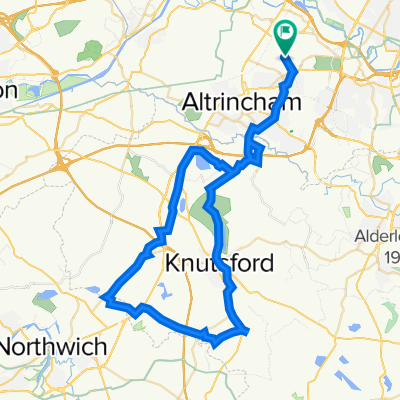
 103km Route_1
- Distance
- 117.1 km
- Ascent
- 730 m
- Descent
- 731 m
- Location
- Timperley, England, United Kingdom
 lazy 😜
- Distance
- 12.8 km
- Ascent
- 54 m
- Descent
- 54 m
- Location
- Timperley, England, United Kingdom
 212 Brooklands Road, Sale to 218 Brooklands Road, Sale
- Distance
- 52.8 km
- Ascent
- 322 m
- Descent
- 324 m
- Location
- Timperley, England, United Kingdom
 Carrswood Road 90A, Sale to Carrswood Road 78, Sale
- Distance
- 17.7 km
- Ascent
- 52 m
- Descent
- 51 m
- Location
- Timperley, England, United Kingdom
 60km Circular Route
- Distance
- 61.3 km
- Ascent
- 297 m
- Descent
- 295 m
- Location
- Timperley, England, United Kingdom
 Slow ride in Manchester
- Distance
- 13.6 km
- Ascent
- 223 m
- Descent
- 222 m
- Location
- Timperley, England, United Kingdom
 Wythenshawe Road to Wythenshawe Road
- Distance
- 30.8 km
- Ascent
- 192 m
- Descent
- 191 m
- Location
- Timperley, England, United Kingdom
 40k route
- Distance
- 53 km
- Ascent
- 194 m
- Descent
- 159 m
- Location
- Timperley, England, United Kingdom
Open it in the app