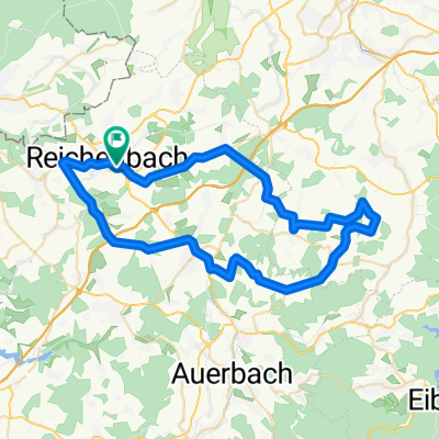
- 52.4 km
- 155 m
- 283 m
- Reichenbach/Vogtland, Saxony, Germany
Rotschau Fichtelberg Klingenthal
A cycling route starting in Reichenbach/Vogtland, Saxony, Germany.
Overview
About this route
I rode this tour in Sept 08 with my road bike. From Rotschau to Fichtelberg, it is !PERFECT! for road biking as the quality of the roads is very good and, due to the side roads, there are hardly any cars to disturb. After Eibenstock, you go up to Sosa, down to Anthonsthal, and back up to Anthonshöhe. This is the little 'suffer' section of the route. After that, it flattens out again until reaching the Fichtelberg. I heavily modeled the route through Czechia after the route of uwe_ewald - thanks for the template. However, next time I would ride differently. The selected side roads are in parts super bad and probably will not get better. You rarely see cars here but I would take them for a better route. So maybe it's better to choose the main roads if you have sympathy for your road bike material. Just the stretch from Nove Hamry should rather go via Prebuz instead of Jeleni. If you also ride up to Bublava, I got lost here and rode back down very bad paths into the (Klingen-)valley - better to stay on the main road through the town center. From Klingenthal, the roads are perfect again. From Klingenthal, you go up the Aschberg again towards Mühlleithen, not really for Sunday riders, who could remain nice in the valley and go to Beerheide via Muldenberg and Hammerbrücke. From Beerheide, the roughness is almost overcome and it is almost all downhill, except between Rodewisch and Lengenfeld and Mhlwand up to Rotschau where some last small bumps await and then there are again 165 km more on the odometer and around 3000 m of elevation gain. A great tour that cost me 7 hours of riding time but can also be split into 2 days.
Best regards, Karsten Franz.
- -:--
- Duration
- 163.7 km
- Distance
- 2,697 m
- Ascent
- 2,626 m
- Descent
- ---
- Avg. speed
- 1,206 m
- Max. altitude
created this 17 years ago
Route quality
Waytypes & surfaces along the route
Waytypes
Road
80.2 km
(49 %)
Quiet road
16.4 km
(10 %)
Surfaces
Paved
113 km
(69 %)
Unpaved
6.5 km
(4 %)
Asphalt
111.3 km
(68 %)
Ground
3.3 km
(2 %)
Continue with Bikemap
Use, edit, or download this cycling route
You would like to ride Rotschau Fichtelberg Klingenthal or customize it for your own trip? Here is what you can do with this Bikemap route:
Free features
- Save this route as favorite or in collections
- Copy & plan your own version of this route
- Split it into stages to create a multi-day tour
- Sync your route with Garmin or Wahoo
Premium features
Free trial for 3 days, or one-time payment. More about Bikemap Premium.
- Navigate this route on iOS & Android
- Export a GPX / KML file of this route
- Create your custom printout (try it for free)
- Download this route for offline navigation
Discover more Premium features.
Get Bikemap PremiumFrom our community
Other popular routes starting in Reichenbach/Vogtland
- Reichenbach im Vogtland, Giegengrün, Plohn, Göltzschtal, Reichenbach
- Steffi zurück 1. Tag
- 60.6 km
- 963 m
- 835 m
- Reichenbach/Vogtland, Saxony, Germany
- Round 1
- 30.8 km
- 317 m
- 317 m
- Reichenbach/Vogtland, Saxony, Germany
- Lange Radrunde durch Reichenbach im Vogtland
- 48.8 km
- 436 m
- 439 m
- Reichenbach/Vogtland, Saxony, Germany
- Schulberg 4, Reichenbach im Vogtland nach Hugo Petters-Straße 5, Kufstein
- 377.1 km
- 701 m
- 566 m
- Reichenbach/Vogtland, Saxony, Germany
- Quarksteine Nidercrinitz
- 29.9 km
- 295 m
- 424 m
- Reichenbach/Vogtland, Saxony, Germany
- Radrunde von Reichenbach im Vogtland nach Netzschkau
- 24.8 km
- 417 m
- 487 m
- Reichenbach/Vogtland, Saxony, Germany
- Vogtlandsee - kleine Morgenrunde
- 62.2 km
- 1,008 m
- 1,010 m
- Reichenbach/Vogtland, Saxony, Germany
Open it in the app


