

Máramaros Csúcsok 2021
A cycling route starting in Săcel, Maramureş County, Romania.
Overview
About this route
Maybe it has a lot of peaks, but it will be good
- -:--
- Duration
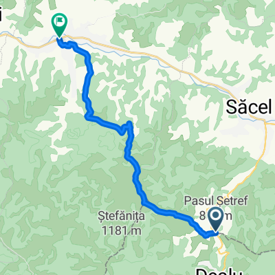
- 181.3 km
- Distance
- 3,335 m
- Ascent
- 3,332 m
- Descent
- ---
- Avg. speed
- ---
- Max. altitude

Route quality
Waytypes & surfaces along the route
Waytypes
Quiet road
68.9 km
(38 %)
Track
39.9 km
(22 %)
Surfaces
Paved
79.8 km
(44 %)
Unpaved
21.8 km
(12 %)
Asphalt
79.8 km
(44 %)
Gravel
12.7 km
(7 %)
Continue with Bikemap
Use, edit, or download this cycling route
You would like to ride Máramaros Csúcsok 2021 or customize it for your own trip? Here is what you can do with this Bikemap route:
Free features
- Save this route as favorite or in collections
- Copy & plan your own version of this route
- Split it into stages to create a multi-day tour
- Sync your route with Garmin or Wahoo
Premium features
Free trial for 3 days, or one-time payment. More about Bikemap Premium.
- Navigate this route on iOS & Android
- Export a GPX / KML file of this route
- Create your custom printout (try it for free)
- Download this route for offline navigation
Discover more Premium features.
Get Bikemap PremiumFrom our community
Other popular routes starting in Săcel
 Máramaros Csúcsok 2021
- Distance
- 181.3 km
- Ascent
- 3,335 m
- Descent
- 3,332 m
- Location
- Săcel, Maramureş County, Romania
 T9-Romuli
- Distance
- 41.1 km
- Ascent
- 858 m
- Descent
- 858 m
- Location
- Săcel, Maramureş County, Romania
 Tura Maramures - ultima zi
- Distance
- 86.7 km
- Ascent
- 733 m
- Descent
- 969 m
- Location
- Săcel, Maramureş County, Romania
 Pas Setref - Salistea de sus V.c.m. scurta (prin dreapta vaii)
- Distance
- 12.1 km
- Ascent
- 288 m
- Descent
- 639 m
- Location
- Săcel, Maramureş County, Romania
 Robi 2021-es szopatása
- Distance
- 151.2 km
- Ascent
- 2,178 m
- Descent
- 2,178 m
- Location
- Săcel, Maramureş County, Romania
 Rumunia #5
- Distance
- 91 km
- Ascent
- 886 m
- Descent
- 904 m
- Location
- Săcel, Maramureş County, Romania
 Setref Climb-Borsa side(4.88%)
- Distance
- 4.5 km
- Ascent
- 264 m
- Descent
- 46 m
- Location
- Săcel, Maramureş County, Romania
 Sacel to DN18, Moisei
- Distance
- 13.1 km
- Ascent
- 386 m
- Descent
- 401 m
- Location
- Săcel, Maramureş County, Romania
Open it in the app