

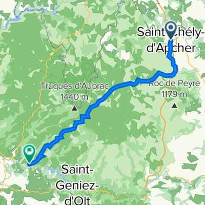
AUV D4 116 km
A cycling route starting in Le Malzieu-Ville, Occitanie, France.
Overview
About this route
- -:--
- Duration
- 111.6 km
- Distance
- 0 m
- Ascent
- 0 m
- Descent
- ---
- Avg. speed
- ---
- Max. altitude

Route quality
Waytypes & surfaces along the route
Waytypes
Road
50.2 km
(45 %)
Quiet road
29 km
(26 %)
Surfaces
Paved
12.3 km
(11 %)
Unpaved
5.6 km
(5 %)
Asphalt
10 km
(9 %)
Gravel
3.3 km
(3 %)
Continue with Bikemap
Use, edit, or download this cycling route
You would like to ride AUV D4 116 km or customize it for your own trip? Here is what you can do with this Bikemap route:
Free features
- Save this route as favorite or in collections
- Copy & plan your own version of this route
- Split it into stages to create a multi-day tour
- Sync your route with Garmin or Wahoo
Premium features
Free trial for 3 days, or one-time payment. More about Bikemap Premium.
- Navigate this route on iOS & Android
- Export a GPX / KML file of this route
- Create your custom printout (try it for free)
- Download this route for offline navigation
Discover more Premium features.
Get Bikemap PremiumFrom our community
Other popular routes starting in Le Malzieu-Ville
 2016 Ride Day 138 - Le Malzieu-Ville to Le-Puy-en-Velay
- Distance
- 70.5 km
- Ascent
- 1,221 m
- Descent
- 1,457 m
- Location
- Le Malzieu-Ville, Occitanie, France
 Liaison GTMC SCA-Ste Eulalie-SCA
- Distance
- 57.4 km
- Ascent
- 1,192 m
- Descent
- 1,194 m
- Location
- Le Malzieu-Ville, Occitanie, France
 Pont de Gabarit château d orfeuillette
- Distance
- 57 km
- Ascent
- 777 m
- Descent
- 737 m
- Location
- Le Malzieu-Ville, Occitanie, France
 GTMC 170901
- Distance
- 42.3 km
- Ascent
- 888 m
- Descent
- 589 m
- Location
- Le Malzieu-Ville, Occitanie, France
 8.etapa Le Malzieu-Ville - Le Puy-en-Velay
- Distance
- 72.4 km
- Ascent
- 1,233 m
- Descent
- 1,432 m
- Location
- Le Malzieu-Ville, Occitanie, France
 TMC2_St-Chély-d'Apcher - St-Flour
- Distance
- 65.1 km
- Ascent
- 2,134 m
- Descent
- 2,251 m
- Location
- Le Malzieu-Ville, Occitanie, France
 ard etape5
- Distance
- 67.3 km
- Ascent
- 1,142 m
- Descent
- 1,763 m
- Location
- Le Malzieu-Ville, Occitanie, France
 AUV D4 116 km
- Distance
- 111.6 km
- Ascent
- 0 m
- Descent
- 0 m
- Location
- Le Malzieu-Ville, Occitanie, France
Open it in the app