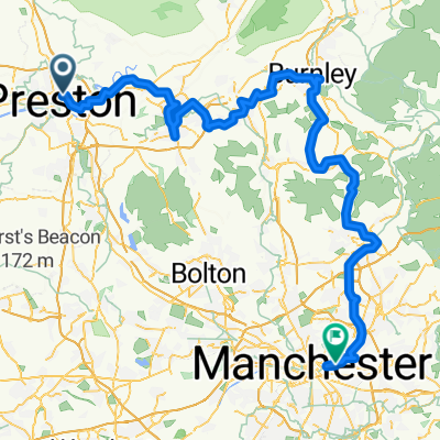
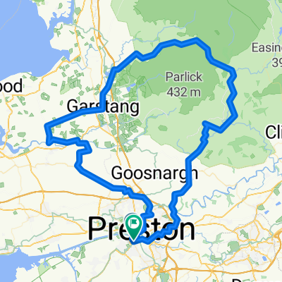
Preston - Beacon Fell - Preston via Longridge
A cycling route starting in Preston, England, United Kingdom.
Overview
About this route
Medium run up to Beacon Fell via Longridge. Quite tough as you approach the fell, few drawn out climbs, but good runout.
- -:--
- Duration
- 50.1 km
- Distance
- 345 m
- Ascent
- 352 m
- Descent
- ---
- Avg. speed
- 244 m
- Avg. speed
Route quality
Waytypes & surfaces along the route
Waytypes
Road
21.8 km
(44 %)
Quiet road
11.8 km
(24 %)
Surfaces
Paved
21.6 km
(43 %)
Unpaved
0.2 km
(<1 %)
Asphalt
19.2 km
(38 %)
Paved (undefined)
2.4 km
(5 %)
Continue with Bikemap
Use, edit, or download this cycling route
You would like to ride Preston - Beacon Fell - Preston via Longridge or customize it for your own trip? Here is what you can do with this Bikemap route:
Free features
- Save this route as favorite or in collections
- Copy & plan your own version of this route
- Sync your route with Garmin or Wahoo
Premium features
Free trial for 3 days, or one-time payment. More about Bikemap Premium.
- Navigate this route on iOS & Android
- Export a GPX / KML file of this route
- Create your custom printout (try it for free)
- Download this route for offline navigation
Discover more Premium features.
Get Bikemap PremiumFrom our community
Other popular routes starting in Preston
- guild wheel
- Distance
- 16.3 km
- Ascent
- 97 m
- Descent
- 71 m
- Location
- Preston, England, United Kingdom
- December Ride Limited light
- Distance
- 90.8 km
- Ascent
- 509 m
- Descent
- 510 m
- Location
- Preston, England, United Kingdom
- Penny - longton
- Distance
- 10 km
- Ascent
- 25 m
- Descent
- 23 m
- Location
- Preston, England, United Kingdom
- Longton Loop
- Distance
- 17.3 km
- Ascent
- 27 m
- Descent
- 26 m
- Location
- Preston, England, United Kingdom
- Preston - Beacon Fell - Preston via Longridge
- Distance
- 50.1 km
- Ascent
- 345 m
- Descent
- 352 m
- Location
- Preston, England, United Kingdom
- penwortham2
- Distance
- 9.3 km
- Ascent
- 14 m
- Descent
- 15 m
- Location
- Preston, England, United Kingdom
- Preston to Scotron loop
- Distance
- 54.7 km
- Ascent
- 247 m
- Descent
- 249 m
- Location
- Preston, England, United Kingdom
- Walton-le-Dale West, South Ribble to 48 Longridge Road, Preston
- Distance
- 10.1 km
- Ascent
- 104 m
- Descent
- 58 m
- Location
- Preston, England, United Kingdom