

Mezőkövesd-Poroszló-híd-Tiszafüred...Mezőkövesd
A cycling route starting in Mezőkövesd, Borsod-Abauj Zemplen county, Hungary.
Overview
About this route
Tiszadorogma(ferry)-Tiszabábolna-Poroszló-Borosdivánka-Egerlővő
- -:--
- Duration
- 88.6 km
- Distance
- 24 m
- Ascent
- 23 m
- Descent
- ---
- Avg. speed
- ---
- Max. altitude

Route quality
Waytypes & surfaces along the route
Waytypes
Access road
22.2 km
(25 %)
Track
17.7 km
(20 %)
Surfaces
Paved
69.1 km
(78 %)
Unpaved
4.4 km
(5 %)
Asphalt
69.1 km
(78 %)
Gravel
4.4 km
(5 %)
Undefined
15.1 km
(17 %)
Continue with Bikemap
Use, edit, or download this cycling route
You would like to ride Mezőkövesd-Poroszló-híd-Tiszafüred...Mezőkövesd or customize it for your own trip? Here is what you can do with this Bikemap route:
Free features
- Save this route as favorite or in collections
- Copy & plan your own version of this route
- Split it into stages to create a multi-day tour
- Sync your route with Garmin or Wahoo
Premium features
Free trial for 3 days, or one-time payment. More about Bikemap Premium.
- Navigate this route on iOS & Android
- Export a GPX / KML file of this route
- Create your custom printout (try it for free)
- Download this route for offline navigation
Discover more Premium features.
Get Bikemap PremiumFrom our community
Other popular routes starting in Mezőkövesd
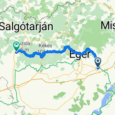 From Mezokövesd to Pásztó
- Distance
- 106.4 km
- Ascent
- 2,043 m
- Descent
- 1,988 m
- Location
- Mezőkövesd, Borsod-Abauj Zemplen county, Hungary
 Mezőkövesd - Eger - Mezőkövesd
- Distance
- 84.5 km
- Ascent
- 687 m
- Descent
- 687 m
- Location
- Mezőkövesd, Borsod-Abauj Zemplen county, Hungary
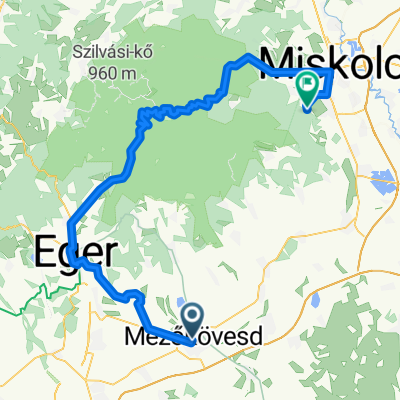 kövesd eger miskolc
- Distance
- 91.7 km
- Ascent
- 781 m
- Descent
- 761 m
- Location
- Mezőkövesd, Borsod-Abauj Zemplen county, Hungary
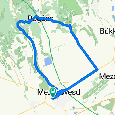
 Mezőkövesd-Borsodivánka-Poroszló-...Mezőkövesd
- Distance
- 85.6 km
- Ascent
- 22 m
- Descent
- 26 m
- Location
- Mezőkövesd, Borsod-Abauj Zemplen county, Hungary
 Felső-szoros
- Distance
- 43.9 km
- Ascent
- 347 m
- Descent
- 344 m
- Location
- Mezőkövesd, Borsod-Abauj Zemplen county, Hungary
 Mezőkövesd-Poroszló-híd-Tiszafüred...Mezőkövesd
- Distance
- 88.6 km
- Ascent
- 24 m
- Descent
- 23 m
- Location
- Mezőkövesd, Borsod-Abauj Zemplen county, Hungary
 Petőfi Sándor utca - Petőfi Sándor utca
- Distance
- 43 km
- Ascent
- 224 m
- Descent
- 212 m
- Location
- Mezőkövesd, Borsod-Abauj Zemplen county, Hungary
 Mezőkövesd vá. - Négyes - Ároktő -Tiszacsege (2011.10.22.)
- Distance
- 46.5 km
- Ascent
- 14 m
- Descent
- 35 m
- Location
- Mezőkövesd, Borsod-Abauj Zemplen county, Hungary
Open it in the app