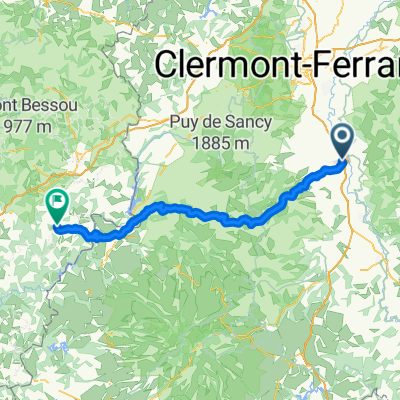
DA Charity Etape 2011 Day 1
A cycling route starting in Issoire, Auvergne-Rh么ne-Alpes, France.
Overview
About this route
First Day of the DA Charity Etape 2011
- -:--
- Duration
- 149.1 km
- Distance
- 2,371 m
- Ascent
- 1,856 m
- Descent
- ---
- Avg. speed
- ---
- Avg. speed
Route quality
Waytypes & surfaces along the route
Waytypes
Busy road
114.1 km
(77 %)
Road
15.4 km
(10 %)
Surfaces
Paved
63 km
(42 %)
Unpaved
0.7 km
(<1 %)
Asphalt
62.9 km
(42 %)
Mud
0.3 km
(<1 %)
Route highlights
Points of interest along the route
Point of interest after 15.8 km
Sharp bend on descent
Point of interest after 26.8 km
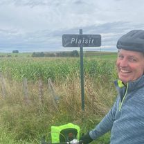
Really good water stop, picnic tables, nice view of old chateau on hill behind
Point of interest after 67.9 km
Lunch spot
Point of interest after 68.2 km
Alternative lunch spot
Point of interest after 79.3 km
Sharp bend on descent
Point of interest after 87.4 km
Windy descent
Point of interest after 114 km
Good water stop, toilets, picnik tables and seats, and shade
Continue with Bikemap
Use, edit, or download this cycling route
You would like to ride DA Charity Etape 2011 Day 1 or customize it for your own trip? Here is what you can do with this Bikemap route:
Free features
- Save this route as favorite or in collections
- Copy & plan your own version of this route
- Sync your route with Garmin or Wahoo
Premium features
Free trial for 3 days, or one-time payment. More about Bikemap Premium.
- Navigate this route on iOS & Android
- Export a GPX / KML file of this route
- Create your custom printout (try it for free)
- Download this route for offline navigation
Discover more Premium features.
Get Bikemap PremiumFrom our community
Other popular routes starting in Issoire
- issoire
- Distance
- 84.2 km
- Ascent
- 1,023 m
- Descent
- 977 m
- Location
- Issoire, Auvergne-Rh么ne-Alpes, France
- TDF 13. Etappe Issoire - Roanne
- Distance
- 139.6 km
- Ascent
- 1,948 m
- Descent
- 2,047 m
- Location
- Issoire, Auvergne-Rh么ne-Alpes, France
- DA Charity Etape 2011 Day 1
- Distance
- 149.1 km
- Ascent
- 2,371 m
- Descent
- 1,856 m
- Location
- Issoire, Auvergne-Rh么ne-Alpes, France
- Nonette 24-07
- Distance
- 37.1 km
- Ascent
- 681 m
- Descent
- 682 m
- Location
- Issoire, Auvergne-Rh么ne-Alpes, France
- De Impasse de l'Union 6, Issoire 脿 Impasse de l'Union 2, Issoire
- Distance
- 17.5 km
- Ascent
- 387 m
- Descent
- 389 m
- Location
- Issoire, Auvergne-Rh么ne-Alpes, France
- 2019-21 Issoire Circle to St-Martin-des-Plains
- Distance
- 23.5 km
- Ascent
- 132 m
- Descent
- 134 m
- Location
- Issoire, Auvergne-Rh么ne-Alpes, France
- Deutschland - Portugal (Berlin - Faro) FR 20 Issoire - Massiac
- Distance
- 55.9 km
- Ascent
- 365 m
- Descent
- 251 m
- Location
- Issoire, Auvergne-Rh么ne-Alpes, France
- 2019-20 Issoire Circle toward Condat-l猫s-Montboissier
- Distance
- 41.7 km
- Ascent
- 619 m
- Descent
- 620 m
- Location
- Issoire, Auvergne-Rh么ne-Alpes, France
Open it in the app