

JP+Fürstenstand
A cycling route starting in Wetzelsdorf, Styria, Austria.
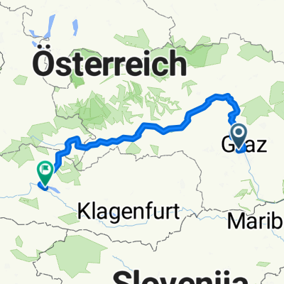
Overview
About this route
- -:--
- Duration
- 28.1 km
- Distance
- 596 m
- Ascent
- 594 m
- Descent
- ---
- Avg. speed
- ---
- Max. altitude

Route quality
Waytypes & surfaces along the route
Waytypes
Quiet road
14.4 km
(51 %)
Track
6.8 km
(24 %)
Surfaces
Paved
17.4 km
(62 %)
Unpaved
7.3 km
(26 %)
Asphalt
16.3 km
(58 %)
Gravel
4.5 km
(16 %)
Continue with Bikemap
Use, edit, or download this cycling route
You would like to ride JP+Fürstenstand or customize it for your own trip? Here is what you can do with this Bikemap route:
Free features
- Save this route as favorite or in collections
- Copy & plan your own version of this route
- Sync your route with Garmin or Wahoo
Premium features
Free trial for 3 days, or one-time payment. More about Bikemap Premium.
- Navigate this route on iOS & Android
- Export a GPX / KML file of this route
- Create your custom printout (try it for free)
- Download this route for offline navigation
Discover more Premium features.
Get Bikemap PremiumFrom our community
Other popular routes starting in Wetzelsdorf
 Mantscha
- Distance
- 37.5 km
- Ascent
- 362 m
- Descent
- 362 m
- Location
- Wetzelsdorf, Styria, Austria
 Graz Tobelbad Schwarzl Graz
- Distance
- 35.4 km
- Ascent
- 297 m
- Descent
- 297 m
- Location
- Wetzelsdorf, Styria, Austria
 Thalerseestraße, Graz nach Schlosserstraße, Köflach
- Distance
- 33.1 km
- Ascent
- 807 m
- Descent
- 771 m
- Location
- Wetzelsdorf, Styria, Austria
 Mantscha-Umrundung
- Distance
- 28 km
- Ascent
- 455 m
- Descent
- 401 m
- Location
- Wetzelsdorf, Styria, Austria
 Kreuzweg - Luderbauer - Orthacker - Aussichtswarte - Johann & Paul - Plabutsch - Gösting - Straßgang CLONED FROM ROUTE 1162102
- Distance
- 33 km
- Ascent
- 790 m
- Descent
- 790 m
- Location
- Wetzelsdorf, Styria, Austria
 Ekkehard-Hauer-Straße nach Burgplatz
- Distance
- 288.4 km
- Ascent
- 5,485 m
- Descent
- 5,279 m
- Location
- Wetzelsdorf, Styria, Austria
 Cecis 2
- Distance
- 22.4 km
- Ascent
- 598 m
- Descent
- 591 m
- Location
- Wetzelsdorf, Styria, Austria
 Armin Laßnitzhöhe 80er
- Distance
- 79.6 km
- Ascent
- 679 m
- Descent
- 679 m
- Location
- Wetzelsdorf, Styria, Austria
Open it in the app