Wenn die Bise weht...
A cycling route starting in Gerlafingen, Canton of Solothurn, Switzerland.
Overview
About this route
Wenn die Bise wirklich stark weht, ist es keine Schande den Zug von Neuchatel nach Solothurn zu nehmen. xx27
- -:--
- Duration
- 65.5 km
- Distance
- 246 m
- Ascent
- 220 m
- Descent
- ---
- Avg. speed
- ---
- Avg. speed
Route quality
Waytypes & surfaces along the route
Waytypes
Busy road
32.9 km
(50 %)
Road
19 km
(29 %)
Surfaces
Paved
52.2 km
(80 %)
Unpaved
0.7 km
(1 %)
Asphalt
50.8 km
(78 %)
Concrete
0.9 km
(1 %)
Continue with Bikemap
Use, edit, or download this cycling route
You would like to ride Wenn die Bise weht... or customize it for your own trip? Here is what you can do with this Bikemap route:
Free features
- Save this route as favorite or in collections
- Copy & plan your own version of this route
- Sync your route with Garmin or Wahoo
Premium features
Free trial for 3 days, or one-time payment. More about Bikemap Premium.
- Navigate this route on iOS & Android
- Export a GPX / KML file of this route
- Create your custom printout (try it for free)
- Download this route for offline navigation
Discover more Premium features.
Get Bikemap PremiumFrom our community
Other popular routes starting in Gerlafingen
- Ausflug mit Familie
- Distance
- 23.9 km
- Ascent
- 130 m
- Descent
- 128 m
- Location
- Gerlafingen, Canton of Solothurn, Switzerland
- Weierhof Subingen
- Distance
- 6 km
- Ascent
- 25 m
- Descent
- 21 m
- Location
- Gerlafingen, Canton of Solothurn, Switzerland
- Hauptstrasse 34, Wiler bei Utzenstorf nach Buchenweg 12, Leuzigen
- Distance
- 27.3 km
- Ascent
- 282 m
- Descent
- 303 m
- Location
- Gerlafingen, Canton of Solothurn, Switzerland
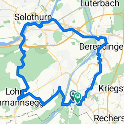
- Gerlafingen Küttigkofen Gerlafingen
- Distance
- 17.5 km
- Ascent
- 169 m
- Descent
- 168 m
- Location
- Gerlafingen, Canton of Solothurn, Switzerland
- Rad-Tour-Männerriege-140723
- Distance
- 19.8 km
- Ascent
- 258 m
- Descent
- 244 m
- Location
- Gerlafingen, Canton of Solothurn, Switzerland
- Wenn die Bise weht...
- Distance
- 65.5 km
- Ascent
- 246 m
- Descent
- 220 m
- Location
- Gerlafingen, Canton of Solothurn, Switzerland
- Ersigen-Limpbach Loop
- Distance
- 42.2 km
- Ascent
- 326 m
- Descent
- 326 m
- Location
- Gerlafingen, Canton of Solothurn, Switzerland
- I'd Stadt
- Distance
- 20.2 km
- Ascent
- 218 m
- Descent
- 220 m
- Location
- Gerlafingen, Canton of Solothurn, Switzerland
Open it in the app