Poljčane-Makole-Slov.Bistrica
A cycling route starting in Poljčane, Občina Poljčane, Slovenia.
Overview
About this route
20.03.2011 sem se popeljal proti Makolam. Osnovna varianta je bila pot okoli Boča, vendar bolečina v kolenu tega ni dopuščala, zato sem skrenil v Pečkah levo proti Slov. Bistrici. Proga primerna za lažji trening saj razen Križnega vrha ni nobenega vzpona, pa še ta je z južne strani bolj položen. Cesta je na določenih odsekih ( Štatenberg-Makole in Mostečno-Kočno ) izredno slaba.
- -:--
- Duration
- 33.2 km
- Distance
- 155 m
- Ascent
- 155 m
- Descent
- ---
- Avg. speed
- ---
- Max. altitude
Route quality
Waytypes & surfaces along the route
Waytypes
Road
11.6 km
(35 %)
Quiet road
2.3 km
(7 %)
Surfaces
Paved
27.3 km
(82 %)
Asphalt
27.3 km
(82 %)
Undefined
6 km
(18 %)
Route highlights
Points of interest along the route

Point of interest after 0.6 km
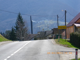
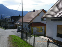
proti centru Poljčan

Point of interest after 0.9 km
O.Š. v Spodnjih Poljčanah

Point of interest after 3.3 km
proti Studenicam

Point of interest after 3.8 km
Studenice pri Poljčanah

Point of interest after 9.1 km
proti Makolam

Point of interest after 9.9 km
makolska cerkev

Point of interest after 10.6 km
dvorec Štatenberg

Point of interest after 10.6 km

Point of interest after 11.6 km
križišče

Point of interest after 13.3 km
Boč iz smeri Mostečno

Point of interest after 22.8 km
ravnica proti Slov.Bistrici. Leon v ospredju

Point of interest after 24.8 km
Boč iz Slov.Bistrice

Point of interest after 29.4 km
žel.prehod-Cigonca

Point of interest after 30.9 km
Boč iz križnega vrha

Point of interest after 31.7 km
ponovno v občini Poljčane

Point of interest after 33.1 km
še tabla Poljčane

Point of interest after 33.2 km
in dom
Continue with Bikemap
Use, edit, or download this cycling route
You would like to ride Poljčane-Makole-Slov.Bistrica or customize it for your own trip? Here is what you can do with this Bikemap route:
Free features
- Save this route as favorite or in collections
- Copy & plan your own version of this route
- Sync your route with Garmin or Wahoo
Premium features
Free trial for 3 days, or one-time payment. More about Bikemap Premium.
- Navigate this route on iOS & Android
- Export a GPX / KML file of this route
- Create your custom printout (try it for free)
- Download this route for offline navigation
Discover more Premium features.
Get Bikemap PremiumFrom our community
Other popular routes starting in Poljčane
 čez Boč
- Distance
- 31.3 km
- Ascent
- 688 m
- Descent
- 691 m
- Location
- Poljčane, Občina Poljčane, Slovenia
 Poljčane-Makole-Slov.Bistrica
- Distance
- 33.2 km
- Ascent
- 155 m
- Descent
- 155 m
- Location
- Poljčane, Občina Poljčane, Slovenia
 STKP 27: Planinski dom na Boču – Gorišnica
- Distance
- 60.8 km
- Ascent
- 903 m
- Descent
- 1,353 m
- Location
- Poljčane, Občina Poljčane, Slovenia
 Poljčane- Boč- Donačk g.- Poljčane
- Distance
- 45.9 km
- Ascent
- 1,892 m
- Descent
- 1,926 m
- Location
- Poljčane, Občina Poljčane, Slovenia
 Okoli Boča
- Distance
- 23.1 km
- Ascent
- 932 m
- Descent
- 936 m
- Location
- Poljčane, Občina Poljčane, Slovenia
 Ptuj-Maribor-Poljčane
- Distance
- 87.1 km
- Ascent
- 361 m
- Descent
- 362 m
- Location
- Poljčane, Občina Poljčane, Slovenia
 MTB: Poljčane - Boč - Poljčane
- Distance
- 18.7 km
- Ascent
- 842 m
- Descent
- 842 m
- Location
- Poljčane, Občina Poljčane, Slovenia
 MTB: Poljčane - Boč (Stolp)
- Distance
- 26.2 km
- Ascent
- 934 m
- Descent
- 938 m
- Location
- Poljčane, Občina Poljčane, Slovenia
Open it in the app


