

Pont-Farcy - Agon-Coutainville (plan B)
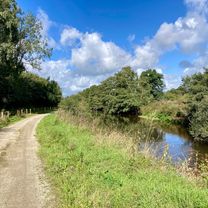
A cycling route starting in Tessy-sur-Vire, Normandy, France.
Overview
About this route
- -:--
- Duration
- 58.6 km
- Distance
- 349 m
- Ascent
- 376 m
- Descent
- ---
- Avg. speed
- ---
- Max. altitude

Route quality
Waytypes & surfaces along the route
Waytypes
Road
43.9 km
(75 %)
Path
4.7 km
(8 %)
Surfaces
Paved
29.3 km
(50 %)
Unpaved
1.8 km
(3 %)
Asphalt
28.7 km
(49 %)
Gravel
1.8 km
(3 %)
Continue with Bikemap
Use, edit, or download this cycling route
You would like to ride Pont-Farcy - Agon-Coutainville (plan B) or customize it for your own trip? Here is what you can do with this Bikemap route:
Free features
- Save this route as favorite or in collections
- Copy & plan your own version of this route
- Sync your route with Garmin or Wahoo
Premium features
Free trial for 3 days, or one-time payment. More about Bikemap Premium.
- Navigate this route on iOS & Android
- Export a GPX / KML file of this route
- Create your custom printout (try it for free)
- Download this route for offline navigation
Discover more Premium features.
Get Bikemap PremiumFrom our community
Other popular routes starting in Tessy-sur-Vire
 Pont-Farcy - Agon-Coutainville (plan B)
- Distance
- 58.6 km
- Ascent
- 349 m
- Descent
- 376 m
- Location
- Tessy-sur-Vire, Normandy, France
 Rondje Landelle de Coupigny
- Distance
- 19.5 km
- Ascent
- 217 m
- Descent
- 241 m
- Location
- Tessy-sur-Vire, Normandy, France
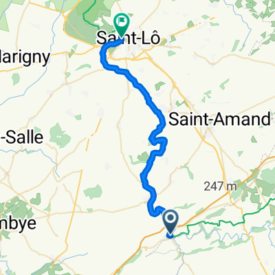
 Pont-Farcy - Saint-Lô
- Distance
- 31.3 km
- Ascent
- 212 m
- Descent
- 174 m
- Location
- Tessy-sur-Vire, Normandy, France
 Normandië- Heist
- Distance
- 735.4 km
- Ascent
- 489 m
- Descent
- 532 m
- Location
- Tessy-sur-Vire, Normandy, France
 De 4 Route de Tessy, Pont-Farcy à 50 Rue Général Huard, Villedieu-les-Poêles
- Distance
- 18.4 km
- Ascent
- 333 m
- Descent
- 255 m
- Location
- Tessy-sur-Vire, Normandy, France
 Pont-Farcy - Carentan
- Distance
- 74.7 km
- Ascent
- 130 m
- Descent
- 179 m
- Location
- Tessy-sur-Vire, Normandy, France
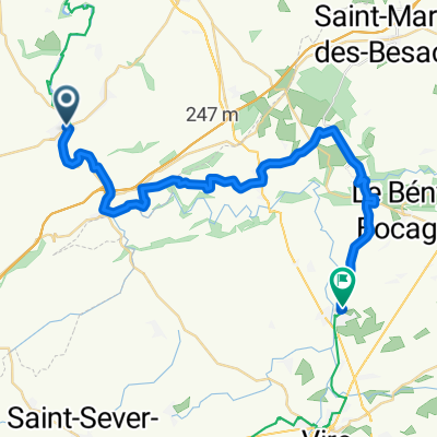 Route de St-Lô, Tessy-sur-Vire à Route des Frairies, Souleuvre en Bocage
- Distance
- 33.3 km
- Ascent
- 579 m
- Descent
- 533 m
- Location
- Tessy-sur-Vire, Normandy, France
 Pont-Farcy / Saint-Lô
- Distance
- 32 km
- Ascent
- 173 m
- Descent
- 209 m
- Location
- Tessy-sur-Vire, Normandy, France
Open it in the app