

Gaja-Tour
A cycling route starting in Csetény, Veszprém megye, Hungary.
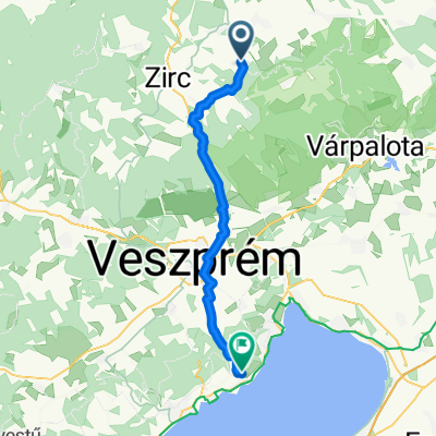
Overview
About this route
Végig aszfalt, jó útvonal.
Szápár-Tés kicsit húzós szakasz, a többi laza.
- -:--
- Duration
- 29.1 km
- Distance
- 423 m
- Ascent
- 419 m
- Descent
- ---
- Avg. speed
- ---
- Max. altitude

Route quality
Waytypes & surfaces along the route
Waytypes
Quiet road
8.4 km
(29 %)
Road
6.4 km
(22 %)
Undefined
14.2 km
(49 %)
Surfaces
Paved
23.5 km
(81 %)
Asphalt
23.3 km
(80 %)
Paved (undefined)
0.3 km
(1 %)
Undefined
5.5 km
(19 %)
Continue with Bikemap
Use, edit, or download this cycling route
You would like to ride Gaja-Tour or customize it for your own trip? Here is what you can do with this Bikemap route:
Free features
- Save this route as favorite or in collections
- Copy & plan your own version of this route
- Sync your route with Garmin or Wahoo
Premium features
Free trial for 3 days, or one-time payment. More about Bikemap Premium.
- Navigate this route on iOS & Android
- Export a GPX / KML file of this route
- Create your custom printout (try it for free)
- Download this route for offline navigation
Discover more Premium features.
Get Bikemap PremiumFrom our community
Other popular routes starting in Csetény
 Meg a Bakony javitott_
- Distance
- 29 km
- Ascent
- 441 m
- Descent
- 441 m
- Location
- Csetény, Veszprém megye, Hungary
 KDP Kelet-Bakonyi Piros 2
- Distance
- 24.2 km
- Ascent
- 308 m
- Descent
- 493 m
- Location
- Csetény, Veszprém megye, Hungary
 Meg-a Bakony 2013
- Distance
- 30.6 km
- Ascent
- 512 m
- Descent
- 511 m
- Location
- Csetény, Veszprém megye, Hungary
 Gaja utca - Endrődi Sándor utca
- Distance
- 41.8 km
- Ascent
- 399 m
- Descent
- 562 m
- Location
- Csetény, Veszprém megye, Hungary
 Bakonynána-Tés. Light
- Distance
- 19.6 km
- Ascent
- 333 m
- Descent
- 305 m
- Location
- Csetény, Veszprém megye, Hungary
 Névtelen út, Bakonynána - Illés József utca 29, Balatonfüred
- Distance
- 72.1 km
- Ascent
- 429 m
- Descent
- 646 m
- Location
- Csetény, Veszprém megye, Hungary
 Gaja-Tour
- Distance
- 29.1 km
- Ascent
- 423 m
- Descent
- 419 m
- Location
- Csetény, Veszprém megye, Hungary
 Ördög-árok - cseszneki vár
- Distance
- 19.5 km
- Ascent
- 372 m
- Descent
- 272 m
- Location
- Csetény, Veszprém megye, Hungary
Open it in the app