

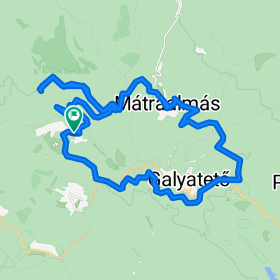
Panoráma Körút a Felső Mátrában
A cycling route starting in Bátonyterenye, Nógrád megye, Hungary.
Overview
About this route
The north side of the country road, from the Rudolftanya junction to the Bőgős meadow, has a solid road surface.
- -:--
- Duration
- 19.4 km
- Distance
- 308 m
- Ascent
- 306 m
- Descent
- ---
- Avg. speed
- ---
- Max. altitude

Route quality
Waytypes & surfaces along the route
Waytypes
Quiet road
9.9 km
(51 %)
Track
6.8 km
(35 %)
Surfaces
Paved
12.1 km
(62 %)
Unpaved
6.8 km
(35 %)
Asphalt
12.1 km
(62 %)
Ground
3.7 km
(19 %)
Continue with Bikemap
Use, edit, or download this cycling route
You would like to ride Panoráma Körút a Felső Mátrában or customize it for your own trip? Here is what you can do with this Bikemap route:
Free features
- Save this route as favorite or in collections
- Copy & plan your own version of this route
- Sync your route with Garmin or Wahoo
Premium features
Free trial for 3 days, or one-time payment. More about Bikemap Premium.
- Navigate this route on iOS & Android
- Export a GPX / KML file of this route
- Create your custom printout (try it for free)
- Download this route for offline navigation
Discover more Premium features.
Get Bikemap PremiumFrom our community
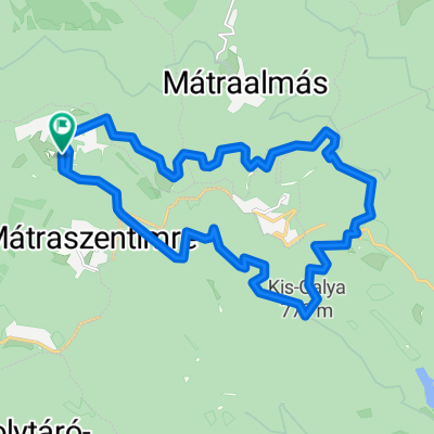
Other popular routes starting in Bátonyterenye
 OKKT 2 - Heves-Borsodi-dombság
- Distance
- 81.5 km
- Ascent
- 505 m
- Descent
- 505 m
- Location
- Bátonyterenye, Nógrád megye, Hungary
 Panoráma Körút a Felső Mátrában
- Distance
- 19.4 km
- Ascent
- 308 m
- Descent
- 306 m
- Location
- Bátonyterenye, Nógrád megye, Hungary
 Karancs
- Distance
- 52.4 km
- Ascent
- 413 m
- Descent
- 417 m
- Location
- Bátonyterenye, Nógrád megye, Hungary
 Kisterenye-Szilvásvárad-Eger (Mátra@Bükk)
- Distance
- 92.1 km
- Ascent
- 468 m
- Descent
- 505 m
- Location
- Bátonyterenye, Nógrád megye, Hungary
 Kazár-Riolittufa
- Distance
- 22.2 km
- Ascent
- 194 m
- Descent
- 194 m
- Location
- Bátonyterenye, Nógrád megye, Hungary
 Mátra kiskör
- Distance
- 27.9 km
- Ascent
- 473 m
- Descent
- 467 m
- Location
- Bátonyterenye, Nógrád megye, Hungary
 Kellemes 20 km
- Distance
- 20.2 km
- Ascent
- 310 m
- Descent
- 310 m
- Location
- Bátonyterenye, Nógrád megye, Hungary
 Kis edzés a Mátra északi lábánál I.
- Distance
- 54 km
- Ascent
- 532 m
- Descent
- 532 m
- Location
- Bátonyterenye, Nógrád megye, Hungary
Open it in the app